Approximate Location Map
Large Map »
Latitude: 56.1228 / 56°7'22"N
Longitude: -3.1243 / 3°7'27"W
OS Eastings: 330200
OS Northings: 692800
OS Grid: NT302928
Mapcode National: GBR 2C.L61B
Mapcode Global: WH6RV.ZCDJ
Plus Code: 9C8R4VFG+47
Entry Name: Dysart Harbour
Listing Name: Dysart Harbour
Listing Date: 28 January 1971
Category: B
Source: Historic Scotland
Source ID: 381182
Historic Scotland Designation Reference: LB36406
Building Class: Cultural
ID on this website: 200381182
Location: Kirkcaldy
County: Fife
Town: Kirkcaldy
Electoral Ward: Kirkcaldy East
Traditional County: Fife
Tagged with: Harbour
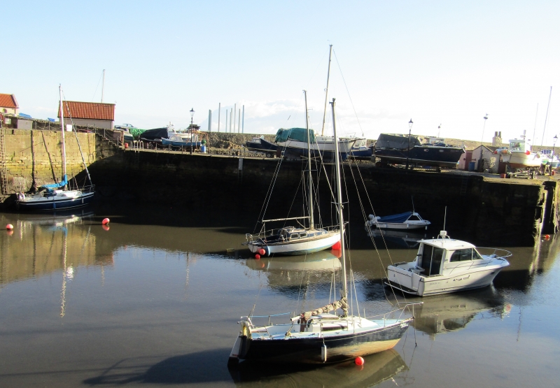
Early 17th century tidal basin; 1831 wet dock; restored 1967. Roughly U-plan tidal basin with harbour mouth to S (at rounded end) and slipway to N; W arm with jetties projecting at W and NW forming mouth to almost rhomboidal-plan wet dock at NW. E pier with high ashlar sea wall to SE. Harbour walls largely ashlar, parts in vertical courses; stone sets to slipways.
Dysart was a port in 1450, and until the early 17th century it had a pier at nearby Pan Ha'. The current harbour plan appears on a map of 1750, and shipbuilding was practised from 1764 until circa 1900. Export trade in salt and coal (mainly to the Low Countries) was common from the fifteenth century, with Dysart becoming a separate burgh early in the sixteenth century. Work began on the present harbour early in the 17th century, funded by the Town Council and Lord Sinclair. Robert Stevenson was commissioned to report on the harbour's state in 1819, when coal from the Lady Blanche colliery was a major export, and in 1829 the new inner dock was complete, it "included an inner harbour which, closed by dock gates, allowed ships to load coal at all stages of the tide" and "was the first harbour on the east coast of Scotland to have such a facility" (Swan & McNeill, p19). In 1843 a violent storm washed away 100ft of the E pier. The Lady Blanche Colliery was closed in 1928 and the harbour ceased commercially in 1929. It lay derelict until 1967 when it was taken over by Dysart Sailing Club who now lease it from local authority.
External links are from the relevant listing authority and, where applicable, Wikidata. Wikidata IDs may be related buildings as well as this specific building. If you want to add or update a link, you will need to do so by editing the Wikidata entry.


Other nearby listed buildings
