Approximate Location Map
Large Map »
Latitude: 55.6739 / 55°40'25"N
Longitude: -3.781 / 3°46'51"W
OS Eastings: 288089
OS Northings: 643703
OS Grid: NS880437
Mapcode National: GBR 221T.6X
Mapcode Global: WH5SJ.WNP5
Plus Code: 9C7RM6F9+HH
Entry Name: 20 Bloomgate, Lanark
Listing Name: 18 and 20 Bloomgate
Listing Date: 7 May 1980
Category: C
Source: Historic Scotland
Source ID: 381845
Historic Scotland Designation Reference: LB36940
Building Class: Cultural
ID on this website: 200381845
Location: Lanark
County: South Lanarkshire
Town: Lanark
Electoral Ward: Clydesdale North
Traditional County: Lanarkshire
Tagged with: Architectural structure
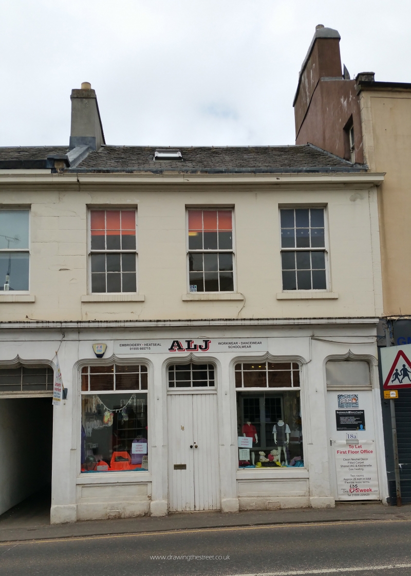
Earlier 19th century. 2 storey and attic, 6 windows.
Lined, painted stucco. Central wide pend with flat ogee
arch. Modern shop front to left, pilastered shop front
to right, with modern fascia. 6 windows to 1st floor,
some with original lying-pane glazing. Cornice and
blocking course. Later canted and gabled dormer to left.
Straight skews, slate roof. Extensive 2 storey rear wings
flanking pend.
External links are from the relevant listing authority and, where applicable, Wikidata. Wikidata IDs may be related buildings as well as this specific building. If you want to add or update a link, you will need to do so by editing the Wikidata entry.


Other nearby listed buildings
