Approximate Location Map
Large Map »
Latitude: 55.9767 / 55°58'36"N
Longitude: -3.5974 / 3°35'50"W
OS Eastings: 300413
OS Northings: 677119
OS Grid: NT004771
Mapcode National: GBR 1S.WFSJ
Mapcode Global: WH5R8.Q14J
Plus Code: 9C7RXCG3+M2
Entry Name: St Michael's Well, High Street, Linlithgow
Listing Name: High Street, St Michael's Well
Listing Date: 22 February 1971
Category: A
Source: Historic Scotland
Source ID: 382468
Historic Scotland Designation Reference: LB37383
Building Class: Cultural
ID on this website: 200382468
Location: Linlithgow
County: West Lothian
Town: Linlithgow
Electoral Ward: Linlithgow
Traditional County: West Lothian
Tagged with: Well
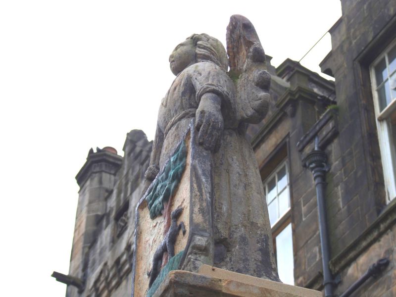
1720. Tall square ashlar pedestal supporting figure of Archangel Michael holding shield with town's coat of arms and base inscribed "1720 Saint Michael is kind to strangers".
The well wasbuilt by the town in 1720. The figure of St Michael was removed from one of the early Cross Wells. Following a traffic accident the water-spout was not re-installed on the pedestal.
External links are from the relevant listing authority and, where applicable, Wikidata. Wikidata IDs may be related buildings as well as this specific building. If you want to add or update a link, you will need to do so by editing the Wikidata entry.


Other nearby listed buildings
