Approximate Location Map
Large Map »
Latitude: 57.5879 / 57°35'16"N
Longitude: -3.8712 / 3°52'16"W
OS Eastings: 288231
OS Northings: 856861
OS Grid: NH882568
Mapcode National: GBR J8TN.TNV
Mapcode Global: WH4G2.HJSW
Plus Code: 9C9RH4QH+5G
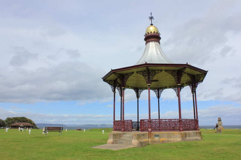
Entry Name: Bandstand, Marine Road, Nairn
Listing Name: Marine Road, Bandstand
Listing Date: 12 March 1981
Category: A
Source: Historic Scotland
Source ID: 383817
Historic Scotland Designation Reference: LB38450
Building Class: Cultural
ID on this website: 200383817
Location: Nairn
County: Highland
Town: Nairn
Electoral Ward: Nairn and Cawdor
Traditional County: Nairnshire
Tagged with: Bandstand
Later 19th century, ornate polygonal cast-iron band stand. Stone base, cast-iron columns with decorative brackets and balustrade. Steeply curved lead covered roof rising to decorative collar framing ball and cast-iron finials.
Does not appear on 1870 OS but on the 1905 edition.
External links are from the relevant listing authority and, where applicable, Wikidata. Wikidata IDs may be related buildings as well as this specific building. If you want to add or update a link, you will need to do so by editing the Wikidata entry.


Other nearby listed buildings
