Approximate Location Map
Large Map »
Latitude: 57.5824 / 57°34'56"N
Longitude: -3.8647 / 3°51'52"W
OS Eastings: 288605
OS Northings: 856237
OS Grid: NH886562
Mapcode National: GBR J8TP.BFK
Mapcode Global: WH4G2.LPX3
Plus Code: 9C9RH4JP+X4
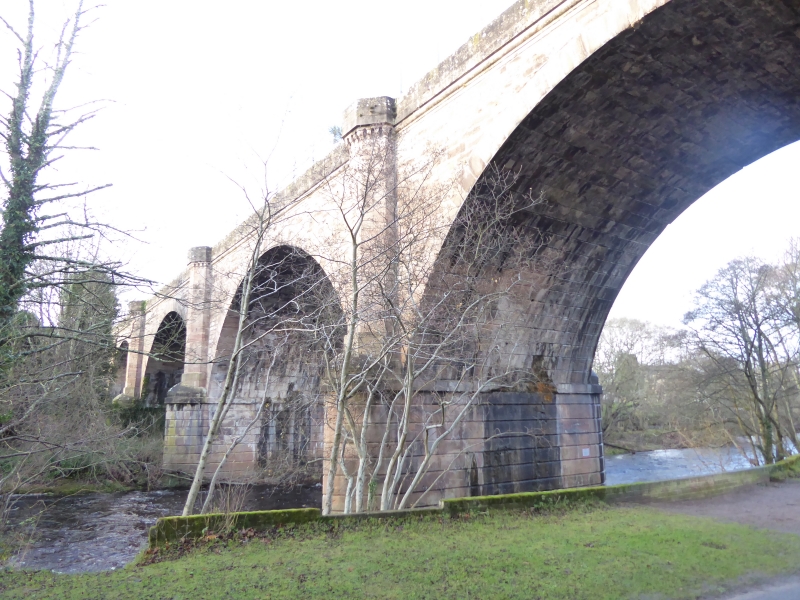
Entry Name: Railway Viaduct, Nairn
Listing Name: Nairn Viaduct over River Nairn
Listing Date: 26 January 1971
Category: B
Source: Historic Scotland
Source ID: 383829
Historic Scotland Designation Reference: LB38457
Building Class: Cultural
ID on this website: 200383829
Location: Nairn
County: Highland
Town: Nairn
Electoral Ward: Nairn and Cawdor
Traditional County: Nairnshire
Tagged with: Stone arch bridge Railway viaduct
1856-7. 4 span viaduct crossing Nairn River coursed rubble,
ashlar parapet, dressed stone arches. Pointed cut-waters
carried up to form corbelled refuges linked at parapet level
by rolled string course.
Opened by Inverness and Aberdeen Junction Railway, 1857.
Stone from Kingsteps Quarry Nairn.
External links are from the relevant listing authority and, where applicable, Wikidata. Wikidata IDs may be related buildings as well as this specific building. If you want to add or update a link, you will need to do so by editing the Wikidata entry.


Other nearby listed buildings
