Approximate Location Map
Large Map »
Latitude: 55.8454 / 55°50'43"N
Longitude: -4.4226 / 4°25'21"W
OS Eastings: 248414
OS Northings: 664012
OS Grid: NS484640
Mapcode National: GBR 3K.4PQW
Mapcode Global: WH3P6.1B8N
Plus Code: 9C7QRHWG+5X
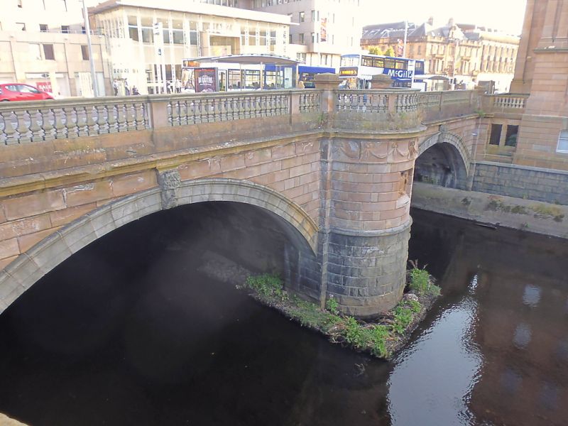
Entry Name: St James' Bridge, Gauze Street, Paisley
Listing Name: St James' Bridge
Listing Date: 27 March 1985
Category: B
Source: Historic Scotland
Source ID: 384650
Historic Scotland Designation Reference: LB39102
Building Class: Cultural
ID on this website: 200384650
Location: Paisley
County: Renfrewshire
Town: Paisley
Electoral Ward: Paisley East and Central
Traditional County: Renfrewshire
Tagged with: Bridge
Dated 1883. Italianate, 2-span bridge with semi-circular
central abutment. Channelled ashlar with architraved
voussoirs to segmental arches. Carved head keystones.
Abutment has sculpted panel and garland frieze. Cornice
Columns coupled and set forward to central opening.
and balustraded parapet. Only south side survives.
In same style as Town Hall and designed as part of that
scheme.
External links are from the relevant listing authority and, where applicable, Wikidata. Wikidata IDs may be related buildings as well as this specific building. If you want to add or update a link, you will need to do so by editing the Wikidata entry.


Other nearby listed buildings
