Approximate Location Map
Large Map »
Latitude: 56.3394 / 56°20'21"N
Longitude: -2.7875 / 2°47'15"W
OS Eastings: 351413
OS Northings: 716619
OS Grid: NO514166
Mapcode National: GBR 2R.4HPT
Mapcode Global: WH7S0.4XWH
Plus Code: 9C8V86Q6+QX
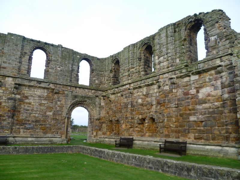
Entry Name: St Andrews Priory
Listing Date: 23 February 1971
Category: A
Source: Historic Scotland
Source ID: 386534
Historic Scotland Designation Reference: LB40586
Building Class: Cultural
ID on this website: 200386534
Location: St Andrews
County: Fife
Town: St Andrews
Electoral Ward: St Andrews
Traditional County: Fife
Tagged with: Priory
Ruin, largely 13th century; W range 16th century. Lower floors only remain, partly restored in red stone by John Kinross for Marquis of Bute, 1890s.
Guardianship Monument.
External links are from the relevant listing authority and, where applicable, Wikidata. Wikidata IDs may be related buildings as well as this specific building. If you want to add or update a link, you will need to do so by editing the Wikidata entry.


Other nearby listed buildings
