Approximate Location Map
Large Map »
Latitude: 56.3399 / 56°20'23"N
Longitude: -2.79 / 2°47'24"W
OS Eastings: 351258
OS Northings: 716672
OS Grid: NO512166
Mapcode National: GBR 2R.4H43
Mapcode Global: WH7S0.3XP4
Plus Code: 9C8V86Q5+XX
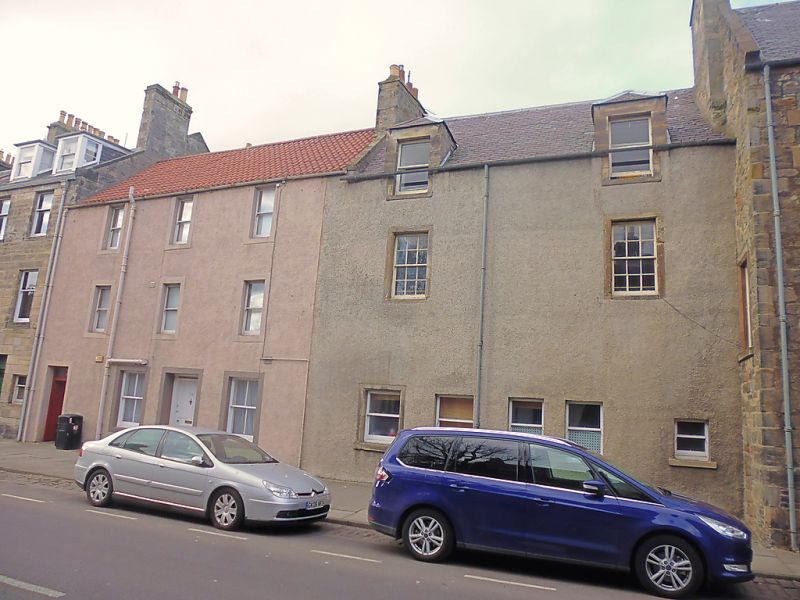
Entry Name: 7-9 South Street, St Andrews
Listing Name: 7, (9) South Street
Listing Date: 28 April 1959
Category: B
Source: Historic Scotland
Source ID: 386552
Historic Scotland Designation Reference: LB40603
Building Class: Cultural
ID on this website: 200386552
Location: St Andrews
County: Fife
Town: St Andrews
Electoral Ward: St Andrews
Traditional County: Fife
Tagged with: Architectural structure
Remodelled c.1790, E section (7) projecting front; 3-storey; 4-window
(1 blind), rubble with margins, architraved doorpiece with fluted frieze and cornice, skewputts one with 18th century date, weather-worn.
W section (9) 16th or 17th century much altered, 3-storey; harled with margins 2 piended dormer heads. Vaulted ground.
External links are from the relevant listing authority and, where applicable, Wikidata. Wikidata IDs may be related buildings as well as this specific building. If you want to add or update a link, you will need to do so by editing the Wikidata entry.


Other nearby listed buildings
