Approximate Location Map
Large Map »
Latitude: 56.3395 / 56°20'22"N
Longitude: -2.7976 / 2°47'51"W
OS Eastings: 350787
OS Northings: 716632
OS Grid: NO507166
Mapcode National: GBR 2R.4FG3
Mapcode Global: WH7S0.0X2G
Plus Code: 9C8V86Q2+QW
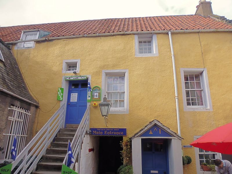
Entry Name: 141 South Street, St Andrews
Listing Name: 141 South Street Within Burgher Close.
Listing Date: 28 April 1959
Category: B
Source: Historic Scotland
Source ID: 386596
Historic Scotland Designation Reference: LB40640
Building Class: Cultural
ID on this website: 200386596
Location: St Andrews
County: Fife
Town: St Andrews
Electoral Ward: St Andrews
Traditional County: Fife
Tagged with: Architectural structure
Early 18th century 3-storey, ochre-washed harl with margins and pantile; 1 swept dormer head; porch with masonic emblems and forestair. Renovated 1964.
External links are from the relevant listing authority and, where applicable, Wikidata. Wikidata IDs may be related buildings as well as this specific building. If you want to add or update a link, you will need to do so by editing the Wikidata entry.


Other nearby listed buildings
