Approximate Location Map
Large Map »
Latitude: 56.3394 / 56°20'21"N
Longitude: -2.7921 / 2°47'31"W
OS Eastings: 351128
OS Northings: 716621
OS Grid: NO511166
Mapcode National: GBR 2R.4GNQ
Mapcode Global: WH7S0.2XPH
Plus Code: 9C8V86Q5+Q5
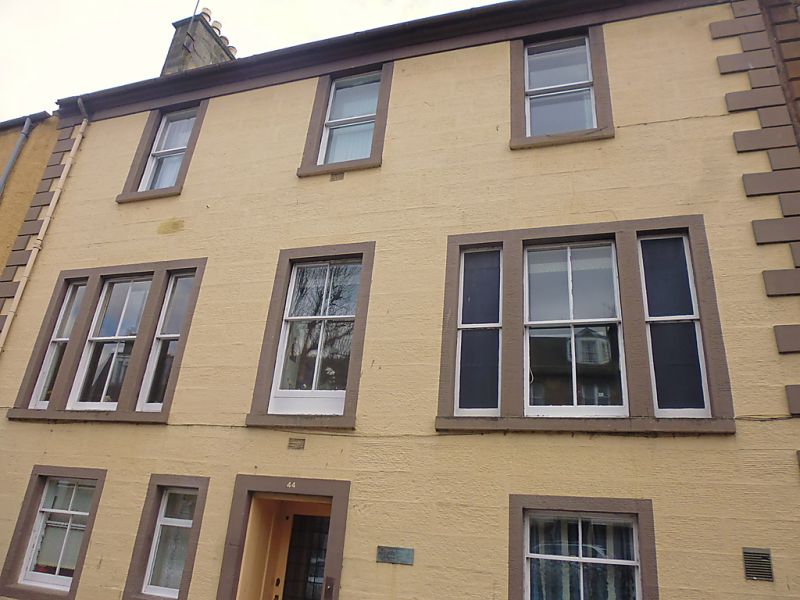
Entry Name: 44 South Street, St Andrews
Listing Name: 44 South Street with Garden Walls of Lang Rig, Including the Parts Now Belonging to Greenside Cottage.
Listing Date: 28 April 1959
Category: B
Source: Historic Scotland
Source ID: 386638
Historic Scotland Designation Reference: LB40677
Building Class: Cultural
ID on this website: 200386638
Location: St Andrews
County: Fife
Town: St Andrews
Electoral Ward: St Andrews
Traditional County: Fife
Tagged with: Architectural structure
Rebuilt early 19th cent. incorporating 16th cent. cellars.
3-storey, 3-window tripartites at 1st floor; droved ashlar
with painted margins and raised quoins; slated. Bow at back.
A Group cont'd.
External links are from the relevant listing authority and, where applicable, Wikidata. Wikidata IDs may be related buildings as well as this specific building. If you want to add or update a link, you will need to do so by editing the Wikidata entry.


Other nearby listed buildings
