Approximate Location Map
Large Map »
Latitude: 56.1225 / 56°7'21"N
Longitude: -3.9401 / 3°56'24"W
OS Eastings: 279485
OS Northings: 693896
OS Grid: NS794938
Mapcode National: GBR 1C.L8SG
Mapcode Global: WH4P6.FCZQ
Plus Code: 9C8R43F5+2X
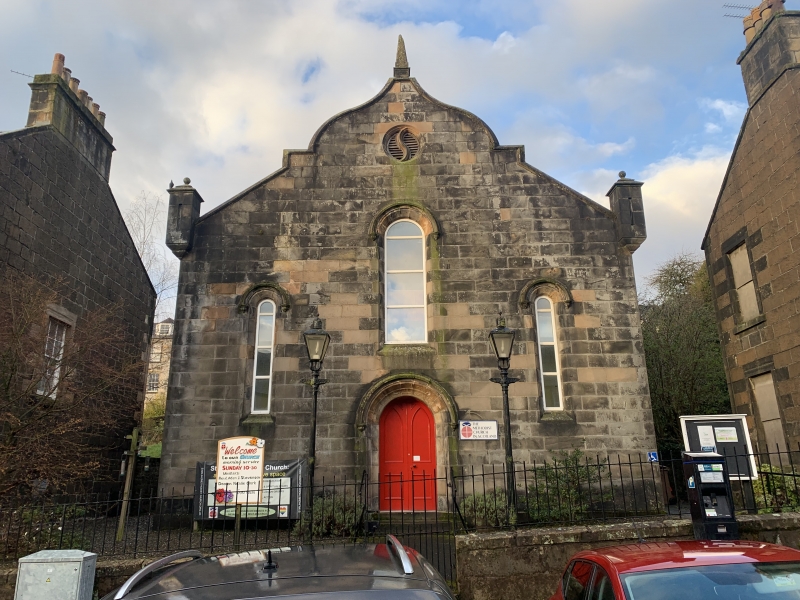
Entry Name: Methodist Church, 19 And 1/2 Queen Street, Stirling
Listing Name: Methodist Church 19-1/2 Queen Street
Listing Date: 4 November 1965
Category: B
Source: Historic Scotland
Source ID: 387186
Historic Scotland Designation Reference: LB41091
Building Class: Cultural
ID on this website: 200387186
Location: Stirling
County: Stirling
Town: Stirling
Electoral Ward: Stirling North
Traditional County: Stirlingshire
Tagged with: Church building
Circa 1840/50 simple plain ashlar Jacobean shaped gable
facade to 3-bay rectangular church; 2 small arched flanking
windows, 1 arched window above door, central arched doorway, hood-moulded with label stops: obelisk finial and corbelled
angle pinnacles.
Ecclesiastical building in use as such.
External links are from the relevant listing authority and, where applicable, Wikidata. Wikidata IDs may be related buildings as well as this specific building. If you want to add or update a link, you will need to do so by editing the Wikidata entry.


Other nearby listed buildings
