Approximate Location Map
Large Map »
Latitude: 56.1218 / 56°7'18"N
Longitude: -3.9398 / 3°56'23"W
OS Eastings: 279504
OS Northings: 693810
OS Grid: NS795938
Mapcode National: GBR 1C.L8VX
Mapcode Global: WH4P6.GD4B
Plus Code: 9C8R43C6+P3
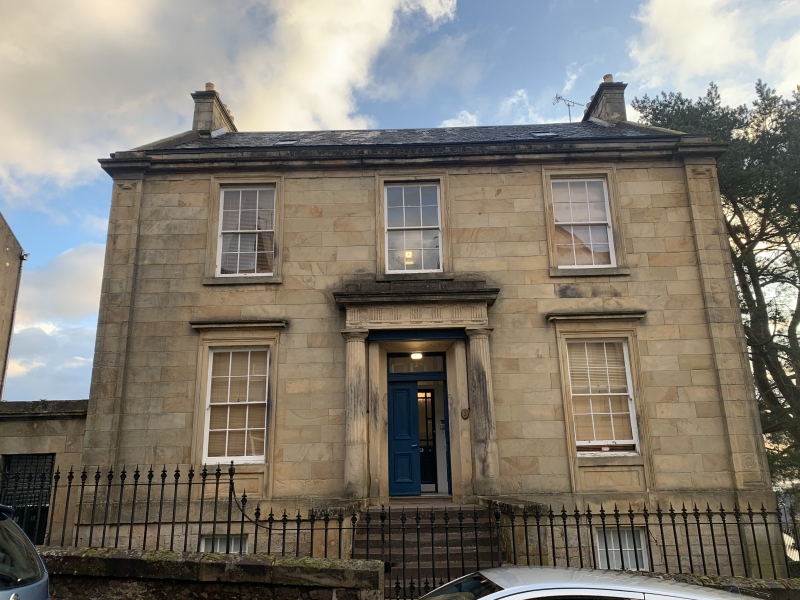
Entry Name: 2 Irvine Place, Stirling
Listing Name: Irvine Place 2
Listing Date: 3 February 1978
Category: B
Source: Historic Scotland
Source ID: 387512
Historic Scotland Designation Reference: LB41319
Building Class: Cultural
ID on this website: 200387512
Location: Stirling
County: Stirling
Town: Stirling
Electoral Ward: Stirling North
Traditional County: Stirlingshire
Tagged with: Villa
Early 19th century. 2-storey and basement 3-window ashlar
fronted classic villa with Greek doric columned doorpiece,
architraved and corniced windows ground floor: pilastered
ends and main cornice. Slated roof. Original glazing.
External links are from the relevant listing authority and, where applicable, Wikidata. Wikidata IDs may be related buildings as well as this specific building. If you want to add or update a link, you will need to do so by editing the Wikidata entry.


Other nearby listed buildings
