Approximate Location Map
Large Map »
Latitude: 56.1225 / 56°7'20"N
Longitude: -3.9399 / 3°56'23"W
OS Eastings: 279500
OS Northings: 693890
OS Grid: NS795938
Mapcode National: GBR 1C.L8VN
Mapcode Global: WH4P6.GC3R
Plus Code: 9C8R43C6+X3
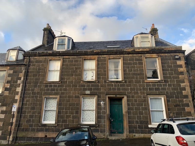
Entry Name: 19 Queen Street, Stirling
Listing Name: Queen Street 19 (S. Side)
Listing Date: 4 November 1965
Category: B
Source: Historic Scotland
Source ID: 387681
Historic Scotland Designation Reference: LB41437
Building Class: Cultural
ID on this website: 200387681
Location: Stirling
County: Stirling
Town: Stirling
Electoral Ward: Stirling North
Traditional County: Stirlingshire
Tagged with: House
2-storey and attic, 4-window whin ashlar, architraves: main
cornice and blocking course, 2 canted dormers. Slated roof.
External links are from the relevant listing authority and, where applicable, Wikidata. Wikidata IDs may be related buildings as well as this specific building. If you want to add or update a link, you will need to do so by editing the Wikidata entry.


Other nearby listed buildings
