Approximate Location Map
Large Map »
Latitude: 52.9227 / 52°55'21"N
Longitude: -3.4384 / 3°26'18"W
OS Eastings: 303390
OS Northings: 337106
OS Grid: SJ033371
Mapcode National: GBR 6L.MZ4P
Mapcode Global: WH786.4SXS
Plus Code: 9C4RWHF6+3J
Entry Name: NO.4 High Street, Clwyd
Listing Date: 20 October 1966
Last Amended: 3 October 2003
Grade: II
Source: Cadw
Source ID: 682
Building Class: Domestic
ID on this website: 300000682
Location: Fronting the High Street in the centre of the village.
County: Denbighshire
Community: Llandrillo
Community: Llandrillo
Traditional County: Merionethshire
Tagged with: Building
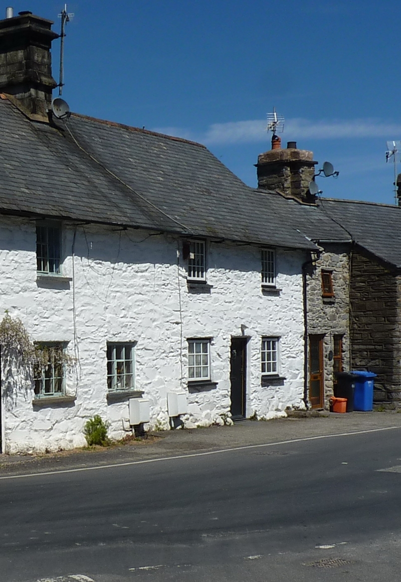
The adjoining Bell Inn is dated 1748.
No 4 has a boarded door offset slightly L of centre flanked by 9-pane wooden windows. Two x 12-pane wooden windows aligned above to upper storey. The E gable end is abutted by further cottages.
No access to interior at time of inspection.
Listed as a C18 cottage of vernacular character which contributes to the Conservation Area. Group value with the Bell Inn and other listed buildings in the village.
External links are from the relevant listing authority and, where applicable, Wikidata. Wikidata IDs may be related buildings as well as this specific building. If you want to add or update a link, you will need to do so by editing the Wikidata entry.


Other nearby listed buildings
