Approximate Location Map
Large Map »
Latitude: 52.9751 / 52°58'30"N
Longitude: -3.1465 / 3°8'47"W
OS Eastings: 323109
OS Northings: 342588
OS Grid: SJ231425
Mapcode National: GBR 6Z.JQ5M
Mapcode Global: WH784.MHW2
Plus Code: 9C4RXVG3+29
Entry Name: Canal Bridge (No.43)
Listing Date: 22 December 1989
Last Amended: 22 December 1989
Grade: II
Source: Cadw
Source ID: 1252
Building Class: Transport
ID on this website: 300001252
Location: Immediately to W of Llandyn Cottage carrying the road up to Llandyn Hall.
County: Denbighshire
Community: Llangollen
Community: Llangollen
Locality: Llandyn
Traditional County: Denbighshire
Tagged with: Bridge
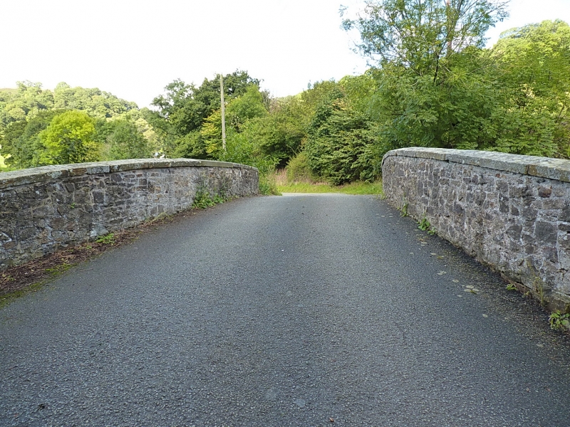
The 6-mile long canal reached Llangollen in 1808 having been proposed as early as 1791 as a branch of the canal that was intended to link the Rivers Mersey and Dee with the Severn. The purpose of the Llangollen branch was primarily that of a feeder to supply the main Ellesmere works. Work was begun in 1804 under the direction of Thomas Telford. In 1846 it became past of the Shropshire Union Railways and Canal Company but the following year was taken over by the LNWR. Transport on the canal diminished in the later C19 with the arrival of the railways and then ceased by the 2nd World War. The canal was only kept open because of its importance as a supplier of water.
Single span rubble of characteristic Telford design. Voussoirs and keystone to the semicircular arch and droved stringcourse and coping to the top. Pyramidical caps to advanced end piers. Battered walls to either side but no walls ramping downwards to towpath. Towpath tuns alongside the S bank.
External links are from the relevant listing authority and, where applicable, Wikidata. Wikidata IDs may be related buildings as well as this specific building. If you want to add or update a link, you will need to do so by editing the Wikidata entry.


Other nearby listed buildings
