Approximate Location Map
Large Map »
Latitude: 51.8121 / 51°48'43"N
Longitude: -2.7127 / 2°42'45"W
OS Eastings: 350963
OS Northings: 212842
OS Grid: SO509128
Mapcode National: GBR FL.X1Q3
Mapcode Global: VH86T.XQR7
Plus Code: 9C3VR76P+RW
Entry Name: House including attached railings
Listing Date: 15 August 1974
Last Amended: 10 August 2005
Grade: II
Source: Cadw
Source ID: 2352
Building Class: Domestic
ID on this website: 300002352
Location: Part of a group in the important residential street leading south-east from the parish church.
County: Monmouthshire
Town: Monmouth
Community: Monmouth (Trefynwy)
Community: Monmouth
Built-Up Area: Monmouth
Traditional County: Monmouthshire
Tagged with: House
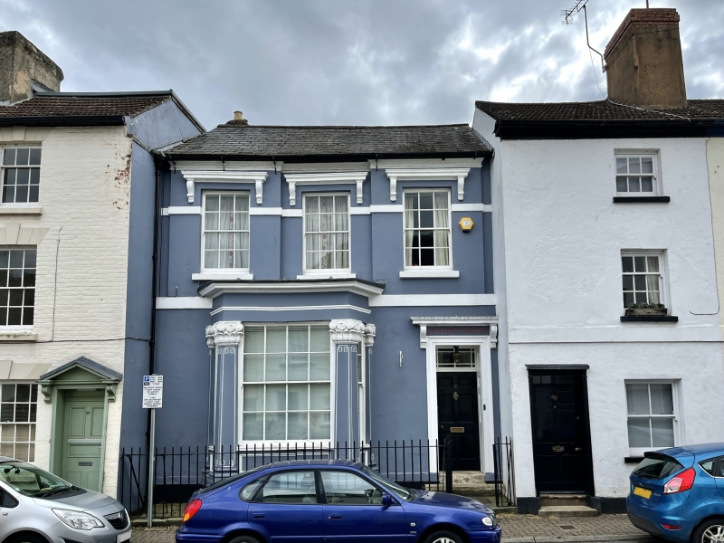
Mid C19, and externally unaltered. It is said to have been both a theatre for travelling players and a Non-Conformist Meeting House in its time.
Stucco fronted and painted, probably over brick, with a Welsh slate roof. Double depth plan with entry to right. Two storeys. Ground floor has a projecting bay window with massive ornate capitals at corners, 8 over 8 pane sash with 1 over 1 in the sidelights. Door in opening similar to windows above, with 6-panels and transom light, and a hood on brackets. Band at first floor. Second floor has three windows with centre one slightly recessed, 6 over 6 pane sashes with hoodmoulds on brackets and impost band. Low pitch roof with stack on rear only. Attached wrought iron spear head railings. Rear elevation not seen.
Interior not seen at resurvey but it is said to retain traces of its historic uses.
Included for its special architectural interest as a Victorian classical house of definite character.
External links are from the relevant listing authority and, where applicable, Wikidata. Wikidata IDs may be related buildings as well as this specific building. If you want to add or update a link, you will need to do so by editing the Wikidata entry.


Other nearby listed buildings
