History in Structure

St. Mary's Churchyard Wall

A Grade II Listed Building in Carew, Pembrokeshire

More Photos »
Approximate Location Map
Large Map »

Coordinates

Latitude: 51.6901 / 51°41'24"N

Longitude: -4.8297 / 4°49'46"W

OS Eastings: 204511

OS Northings: 202833

OS Grid: SN045028

Mapcode National: GBR GB.SL13

Mapcode Global: VH2PJ.7SL6

Plus Code: 9C3QM5RC+34

Entry Name: St. Mary's Churchyard Wall

Listing Date: 14 May 1970

Last Amended: 6 February 1997

Grade: II

Source: Cadw

Source ID: 5944

Building Class: Domestic

ID on this website: 300005944

Location: Wall to the churchyard of St Mary's, with gates to the N, W and S.

County: Pembrokeshire

Town: Tenby

Community: Carew (Caeriw)

Community: Carew

Locality: Carew Cheriton

Traditional County: Pembrokeshire

Tagged with: Wall

Find accommodation in
Carew

Exterior

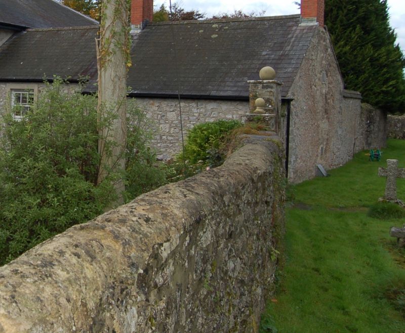
Of variable height, in local rubble masonry, without coping. The wall appears to have been altered or rebuilt piecemeal, as it abuts the C19 stable building of the old Vicarage and the surviving C19 almshouses on the W side. To the N and W sides there are cast-iron gates between gatepiers, the gates to the N being double. There is a blocked gateway to the rear of the old almshouses near to the N gates. There is also an arched gateway in a raised section of the S wall with a timber gate leading to the old Vicarage.
At the end of the old almshouses is a large horse-mounting block, with two flights of steps.

Reasons for Listing

Listed for group value with the Church.

External Links

External links are from the relevant listing authority and, where applicable, Wikidata. Wikidata IDs may be related buildings as well as this specific building. If you want to add or update a link, you will need to do so by editing the Wikidata entry.

Recommended Books

Other nearby listed buildings

  • I Old Mortuary Chapel
    Within St Mary's Churchyard, about 30 m NW of the Church.
  • II Old Almshouses
    At NW corner of St. Mary's churchyard, facing W to the lane. The almshouses are the last two remaining from a row known in the C19 as 'Alms Row'. A mounting-block is adjacent to the N gable.
  • I Church Of St. Mary
    In Carew Cheriton, 300 m S of the A477.
  • II Grove Manor
    In extensive grounds immediately S of St Mary's churchyard. There is a gateway in the churchyard wall for the use of this house. High boundary wall to the access lane with iron gate.
  • II Old School and Schoolteacher's House
    In the village of Carew Cheriton about 100 m N of the Church. There is a small playground at the N of the school and a garden S of the house.
  • II* The Fortified Rectory
    100 m SW of St Mary's churchyard.
  • II Milepost at junction of A477 with A4075
    Immediately west of the junction of the A477 with the A4075, on the S side of Carew Village.
  • II Milton Bridge
    In the village of Milton, about 30 m N of the A477 road.

BritishListedBuildings.co.uk is an independent online resource and is not associated with any government department. All government data published here is used under licence. Please do not contact BritishListedBuildings.co.uk for any queries related to any individual listed building, planning permission related to listed buildings or the listing process itself.

British Listed Buildings is a Good Stuff website.