Approximate Location Map
Large Map »
Latitude: 51.6494 / 51°38'57"N
Longitude: -5.0217 / 5°1'18"W
OS Eastings: 191054
OS Northings: 198832
OS Grid: SR910988
Mapcode National: GBR G6.J3BB
Mapcode Global: VH1S4.XS2Z
Plus Code: 9C3PJXXH+P8
Entry Name: Mounting Platform
Listing Date: 14 May 1970
Last Amended: 8 December 1995
Grade: II
Source: Cadw
Source ID: 5951
Building Class: Domestic
ID on this website: 300005951
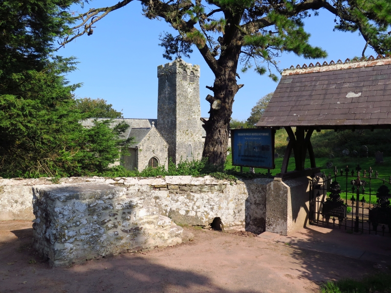
Location: At entrance to St. Michael's churchyard, close to Lichgate.
County: Pembrokeshire
Community: Stackpole and Castlemartin (Stackpole a Chastellmartin)
Community: Castlemartin
Traditional County: Pembrokeshire
Tagged with: Architectural structure
Square platform about 1.1 m high, with six steps, all in rubble masonry. The top consists mostly of a single large slab. Evidently to facilitate mounting a horse, but undatable. Said to have been used until c.1920. Roughly built and oddly positioned away from and at an angle to the churchyard wall.
Also a set of iron rings set in the adjacent wall for tethering horses.
An interesting survival, included for group value with the church.
External links are from the relevant listing authority and, where applicable, Wikidata. Wikidata IDs may be related buildings as well as this specific building. If you want to add or update a link, you will need to do so by editing the Wikidata entry.


Other nearby listed buildings
