Approximate Location Map
Large Map »
Latitude: 51.645 / 51°38'42"N
Longitude: -5.0142 / 5°0'51"W
OS Eastings: 191553
OS Northings: 198327
OS Grid: SR915983
Mapcode National: GBR G6.JCBR
Mapcode Global: VH1S5.1XK9
Plus Code: 9C3PJXWP+28
Entry Name: The Old Pound
Listing Date: 14 May 1970
Last Amended: 8 December 1995
Grade: II
Source: Cadw
Source ID: 5952
Building Class: Agriculture and Subsistence
ID on this website: 300005952
Location: At the E end of the village of Castlemartin.
County: Pembrokeshire
Community: Stackpole and Castlemartin (Stackpole a Chastellmartin)
Community: Castlemartin
Traditional County: Pembrokeshire
Tagged with: Architectural structure
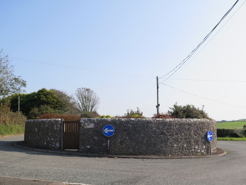
Circular pound for stray cattle, built in 1780. Restored in 1972 by Pembroke Rural District Council. Uncoursed rubble masonry walls, 1.8 m high, with rubble coping. Approximately 13 m diameter. The interior now laid out as a public garden with paths, shrubs and seats. Wooden gate.
Fine example of this type of structure, in an area noted for its cattle farming.
References: RCAHM photographs and notes
Dyfed Arch. Trust: S&M PRN 4680
External links are from the relevant listing authority and, where applicable, Wikidata. Wikidata IDs may be related buildings as well as this specific building. If you want to add or update a link, you will need to do so by editing the Wikidata entry.


Other nearby listed buildings
