Approximate Location Map
Large Map »
Latitude: 51.7979 / 51°47'52"N
Longitude: -3.7293 / 3°43'45"W
OS Eastings: 280844
OS Northings: 212441
OS Grid: SN808124
Mapcode National: GBR Y7.XTVN
Mapcode Global: VH5G3.92TK
Plus Code: 9C3RQ7XC+57
Entry Name: 10 Lamb & Flag Cottages
Listing Date: 17 January 1963
Last Amended: 4 December 2001
Grade: II
Source: Cadw
Source ID: 6606
Building Class: Domestic
ID on this website: 300006606
Location: Situated towards the lower end of terraced row at right angles to the Tawe, reached by a temporary bridge from the Rheolau Arms Inn.
County: Powys
Town: Swansea
Community: Ystradgynlais
Community: Ystradgynlais
Locality: Gwaunclawdd
Traditional County: Brecknockshire
Tagged with: Cottage
In 1801, when Thomas Malkin passed, Pentre'r Lamb was a settlement of two inns and a few houses with a small mine by the river, near the canal-head of the Swansea Canal. The Lamb and Flag Inn and the adjacent No 14, once Lamb and Flag farmhouse may have been originally part of one large house or inn.
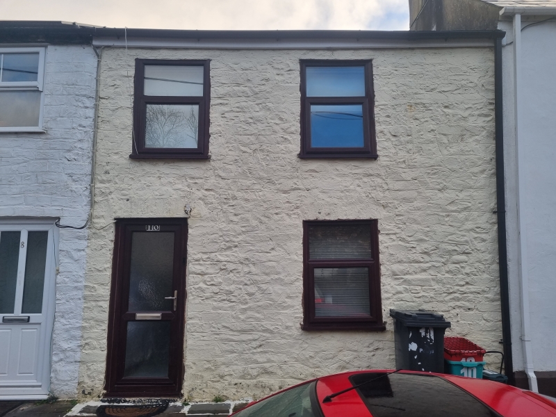
House, former inn, late C18 origins, much altered. White-painted render with slate close-eaved roof and rendered brick end stacks. Two storeys, three-window range of late C20 leaded hardwood windows. Ground floor has large casement pair each side of stuccoed enclosed porch with C20 door to left and C20 window to front. Half-glazed door within. First floor has window to left and 2 smaller windows to centre and right, with hinged top-lights. Ground floor windows have tooled stone sills, first floor windows without sills. Raised plinth. Rear right has NE long rubble stone wing with brick ridge stack, rear left has parallel rear range continued along rear of No 14, one-window with roof hipped at junction with NE range, and side wall chimney.
Not inspected.
Included despite alterations as remnant of a small rural industrial/agricultural settlement illustrative of the early industrial history of the region.
External links are from the relevant listing authority and, where applicable, Wikidata. Wikidata IDs may be related buildings as well as this specific building. If you want to add or update a link, you will need to do so by editing the Wikidata entry.


Other nearby listed buildings
