Approximate Location Map
Large Map »
Latitude: 51.9501 / 51°57'0"N
Longitude: -3.3952 / 3°23'42"W
OS Eastings: 304208
OS Northings: 228879
OS Grid: SO042288
Mapcode National: GBR YP.M6GX
Mapcode Global: VH6BZ.37GW
Plus Code: 9C3RXJ23+3W
Entry Name: Pembrey
Listing Date: 16 December 1976
Last Amended: 4 November 2005
Grade: II
Source: Cadw
Source ID: 6873
Building Class: Domestic
ID on this website: 300006873
Location: On E side of Street, near junction with The Avenue.
County: Powys
Town: Brecon
Community: Brecon (Aberhonddu)
Community: Brecon
Built-Up Area: Brecon
Traditional County: Brecknockshire
Tagged with: House
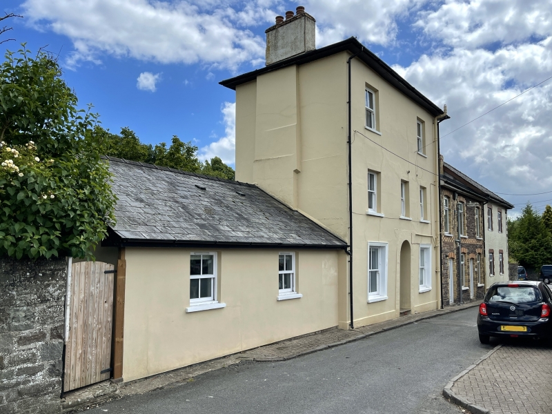
Early-to-mid C19.
House. Street front of three storeys, three windows; cement render. Hipped slate roof with projecting eaves. Sash windows without glazing bars, one at either end on second floor, three on first floor and a wider sash window in each end bay on ground floor. Plain round-headed and painted doorway in centre with half-glazed four-panelled door and plain rectangular fanlight.
One of rare earlier C19 buildings in this part of Brecon to have retained its character..
External links are from the relevant listing authority and, where applicable, Wikidata. Wikidata IDs may be related buildings as well as this specific building. If you want to add or update a link, you will need to do so by editing the Wikidata entry.


Other nearby listed buildings
