Approximate Location Map
Large Map »
Latitude: 51.9518 / 51°57'6"N
Longitude: -3.3906 / 3°23'26"W
OS Eastings: 304524
OS Northings: 229060
OS Grid: SO045290
Mapcode National: GBR YP.M7KM
Mapcode Global: VH6BZ.56VL
Plus Code: 9C3RXJ25+PP
Entry Name: Priory Well
Listing Date: 16 December 1976
Last Amended: 4 November 2005
Grade: II
Source: Cadw
Source ID: 6899
Building Class: Water Supply and Drainage
ID on this website: 300006899
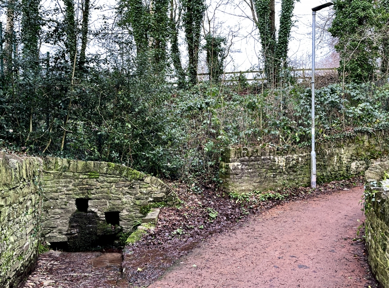
Location: To NE of Cathedral, at top of path known as The Groves.
County: Powys
Town: Brecon
Community: Brecon (Aberhonddu)
Community: Brecon
Built-Up Area: Brecon
Traditional County: Brecknockshire
Tagged with: Well
Well of uncertain date.
Rectangular basin with stone walls, high on west and north sides. Three small rectangular channels cut into northern wall with water issuing into the basin from channel with stone gutter. Steps descend to the basin of the well from the southern side; small area of cobbles to S.
Listed as historic well with well-preserved character. Group Value with walls of The Groves.
External links are from the relevant listing authority and, where applicable, Wikidata. Wikidata IDs may be related buildings as well as this specific building. If you want to add or update a link, you will need to do so by editing the Wikidata entry.


Other nearby listed buildings
