Approximate Location Map
Large Map »
Latitude: 52.5634 / 52°33'48"N
Longitude: -3.1499 / 3°8'59"W
OS Eastings: 322152
OS Northings: 296800
OS Grid: SO221968
Mapcode National: GBR B0.CM5K
Mapcode Global: WH7B2.LT8N
Plus Code: 9C4RHV72+93
Entry Name: Montgomery Castle
Listing Date: 19 July 1950
Last Amended: 16 December 2005
Grade: I
Source: Cadw
Source ID: 7947
Building Class: Defence
Also known as: Castell Trefaldwyn
ID on this website: 300007947
Location: Situated at the top of Castle Hill, reached by footpath from car park by Old Castle Farm.
County: Powys
Town: Montgomery
Community: Montgomery (Trefaldwyn)
Community: Montgomery
Built-Up Area: Montgomery
Traditional County: Montgomeryshire
Tagged with: Castle Archaeological site
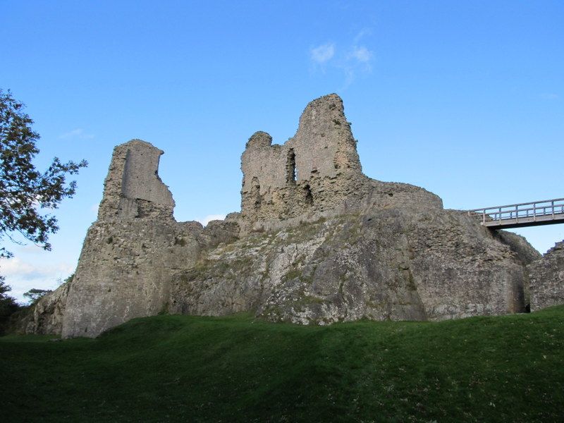
The castle was begun in 1223 to the order of Henry III, firstly in timber, replaced very shortly in stone. The stone curtain of the inner ward with twin-towered gatehouse with red sandstone dressings dated from 1224-33, the gatehouse of the middle ward from 1251, and the curtain of the middle ward probably from 1251-3. Around 1280 there was further strengthening of the town and castle defences following the uprising of Llewelyn ap Gruffydd and in the 1280s buildings such as the kitchen and brewhouse were erected in the Inner Ward. The centre tower of the E curtain wall of the Middle Ward was repaired probably in later C14, when the Well Tower was almost completely rebuilt. Further lodgings were added in 1530s, in the SW angle of the Inner Ward and against the W wall of the Middle Ward, when Rowland Lee, Bishop of Coventry and Lichfield, held the Presidency of the Council of the Marches (1534-43). A mansion of brick and timber was built from c. 1622 on three sides of the Middle Ward for Sir Edward Herbert (later Lord Herbert of Chirbury); described as 'beautiful without and richly furnished within', built by John and Samuel Scampion, carpenters, from Great Hormead, Hertfordshire. Both the castle and the new buildings were levelled by order of Parliament in 1649, and the ruins thereafter pillaged for stone. Considerably more masonry than survives today is shown in the 1742 view by S. and N. Buck. There was a large collapse in 1800. Now in the care of the Welsh Assembly Government.
The scant ruins of a very large medieval castle, sited on a ridge of igneous greenstone overlooking the town, which was founded at the same time as work was begun on the castle. The castle was comprehensively slighted in 1649.
Included as remains of a very large masonry castle.
Scheduled Ancient Monument: MG022 .
External links are from the relevant listing authority and, where applicable, Wikidata. Wikidata IDs may be related buildings as well as this specific building. If you want to add or update a link, you will need to do so by editing the Wikidata entry.


Other nearby listed buildings
