Approximate Location Map
Large Map »
Latitude: 52.2753 / 52°16'31"N
Longitude: -3.0045 / 3°0'16"W
OS Eastings: 331562
OS Northings: 264606
OS Grid: SO315646
Mapcode National: GBR B6.YT3X
Mapcode Global: VH772.W20K
Plus Code: 9C4R7XGW+46
Entry Name: Garrison House
Listing Date: 26 March 1985
Last Amended: 26 March 1985
Grade: II
Source: Cadw
Source ID: 8854
Building Class: Domestic
ID on this website: 300008854
County: Powys
Community: Presteigne (Llanandras)
Community: Presteigne
Built-Up Area: Presteigne
Traditional County: Radnorshire
Tagged with: Architectural structure
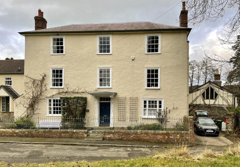
Tall early C19 3 storey pebble dash front over looking the churchyard. Hipped slate roof, projecting eaves, end brick chimneys (set off to left breast). 3 windows, later casements to top floor, sashes with glazing bars in flush frames to 1st floor, tripartites to ground floor. Centre doorway with architrave surround, panelled reveals and 6-panel door under later porch. Brick gable end with stringcourse on right.
Group value.
External links are from the relevant listing authority and, where applicable, Wikidata. Wikidata IDs may be related buildings as well as this specific building. If you want to add or update a link, you will need to do so by editing the Wikidata entry.


Other nearby listed buildings
