Approximate Location Map
Large Map »
Latitude: 52.2702 / 52°16'12"N
Longitude: -3.003 / 3°0'10"W
OS Eastings: 331653
OS Northings: 264033
OS Grid: SO316640
Mapcode National: GBR B6.Z1BG
Mapcode Global: VH772.W6SH
Plus Code: 9C4R7XCW+3Q
Entry Name: The Temple
Listing Date: 26 March 1985
Last Amended: 26 March 1985
Grade: II
Source: Cadw
Source ID: 8857
Building Class: Domestic
ID on this website: 300008857
Location: Reached by roadway between John Beddoes School and the Clatter Brook.
County: Powys
Community: Presteigne (Llanandras)
Community: Presteigne
Built-Up Area: Presteigne
Traditional County: Radnorshire
Tagged with: Building
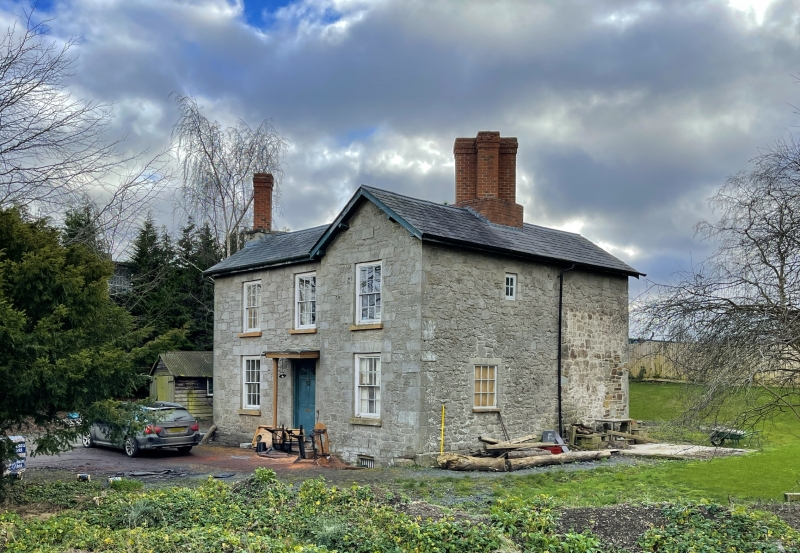
Early to mid C19 2 storey 3 window front with return gable to right and parallel range to rear. Older origins. Rubble with ashlar dressings, shallow slate roofs with wide eaves. Rubble chimney breast to left with single diagonal brick stem, 4 diagonal brick chimneys grouped to right.
Sash windows with glazing bars in flush frames, trellised porch with plain supports over 6-panel door.
Modern 1 storey lean-to extension on rear gable end.
External links are from the relevant listing authority and, where applicable, Wikidata. Wikidata IDs may be related buildings as well as this specific building. If you want to add or update a link, you will need to do so by editing the Wikidata entry.


Other nearby listed buildings
