Approximate Location Map
Large Map »
Latitude: 51.8608 / 51°51'38"N
Longitude: -4.2976 / 4°17'51"W
OS Eastings: 241883
OS Northings: 220514
OS Grid: SN418205
Mapcode National: GBR DG.SYFX
Mapcode Global: VH3LH.GHDD
Plus Code: 9C3QVP62+8X
Entry Name: St John's Priory Precinct Wall or Nun's Walk
Listing Date: 19 May 1981
Last Amended: 28 November 2003
Grade: II
Source: Cadw
Source ID: 9508
Building Class: Religious, Ritual and Funerary
ID on this website: 300009508
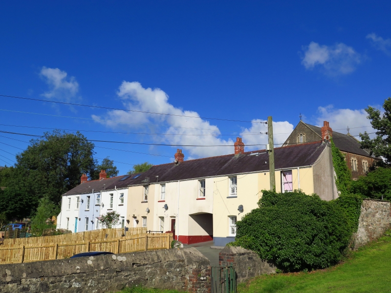
Location: Situated to NE of Nos 6, 7, 7a and 7b, and at NW corner of Parc Hinds playing fields.
County: Carmarthenshire
Community: Carmarthen (Caerfyrddin)
Community: Carmarthen
Built-Up Area: Carmarthen
Traditional County: Carmarthenshire
Tagged with: Wall
Part of precinct wall of Priory of St John. Early Welsh monastic site, originally church of St. Teulyddog (possibly Teilo), reference was made to an Abbot here in the C8. The Normans briefly attempted to install Benedictine monks here before 1125, but then Augustinian canons were installed. The Priory was looted in 1403, and dissolved in 1537. The ''Black Book of Carmarthen'' came from the scriptorium and the famous Eisteddfod of 1450 was probably held in the grounds. Following Dissolution in 1537, the Priory became a private house, some of the buildings gradually falling into ruin. There was a poor-house here in the C18. Most of the site was cleared in 1781 by Lord Cawdor for the establishment of a leadworks. The leadworks had been demolished by 1860. The site has been partly excavated since 1979. This section of wall runs NE from the end of the cottage row that may mark the priory gateway and is very fragmentary.
Wall of stone rubble with medieval foundations below ground comprising the NW precinct wall to the former St John's Priory, excavated in 1979, and now comprising the NW boundary of Parc Hinds, running NE from the former Priory Gateway. Above ground, stone wall with some large boulders, the lower courses thought to be of medieval date. Rises to roughly ten feet high; lower at NE end. At SW end, attached to gable end of No 6 Old Priory Road. NE half of wall is broken down and in need of repair; it runs along the rear of outbuildings.
Included for historical interest as a survival of the Priory and for group value with Nos 6-7b Old Priory Road.
External links are from the relevant listing authority and, where applicable, Wikidata. Wikidata IDs may be related buildings as well as this specific building. If you want to add or update a link, you will need to do so by editing the Wikidata entry.


Other nearby listed buildings
