Approximate Location Map
Large Map »
Latitude: 51.7702 / 51°46'12"N
Longitude: -4.4624 / 4°27'44"W
OS Eastings: 230197
OS Northings: 210813
OS Grid: SN301108
Mapcode National: GBR D7.ZRSN
Mapcode Global: VH3LS.LRSV
Plus Code: 9C3QQGCQ+33
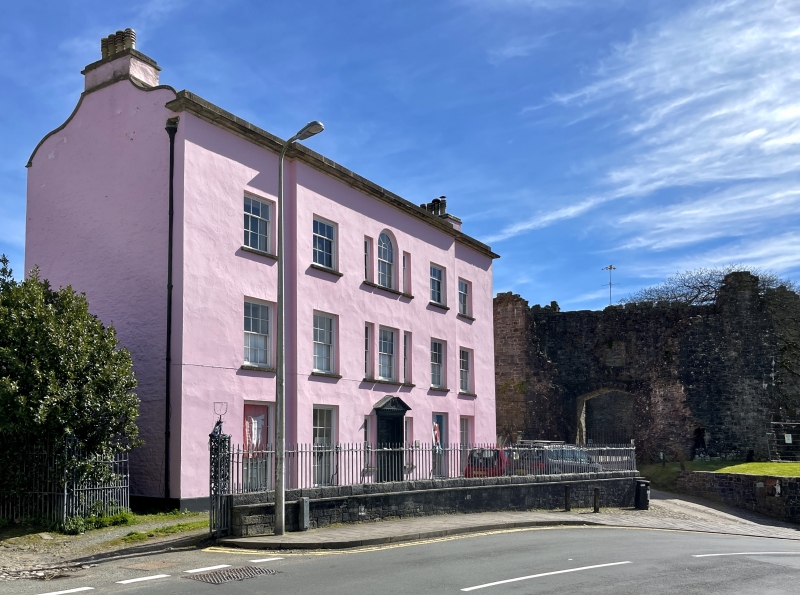
Entry Name: Boundry Wall to W of Castle House, including gated entrance
Listing Date: 25 September 1986
Last Amended: 25 September 1986
Grade: II
Source: Cadw
Source ID: 9658
Building Class: Domestic
ID on this website: 300009658
Location: Lining the road in front of the house and serving as a northern boundary to the Castle area.
County: Carmarthenshire
Community: Laugharne Township (Treflan Lacharn)
Community: Laugharne Township
Built-Up Area: Laugharne
Traditional County: Carmarthenshire
Tagged with: Wall
C18 and C19 rubble wall, set in the slope at altered/extended SW end; turns N and steps down with iron railings on top. At right angles at N end are paired decorative ironwork gates and trelliswork iron gate piers probably contemporary with the ca 1810 remodelling of Castle House.
Group Value
External links are from the relevant listing authority and, where applicable, Wikidata. Wikidata IDs may be related buildings as well as this specific building. If you want to add or update a link, you will need to do so by editing the Wikidata entry.


Other nearby listed buildings
