Approximate Location Map
Large Map »
Latitude: 52.4021 / 52°24'7"N
Longitude: -4.0742 / 4°4'27"W
OS Eastings: 258986
OS Northings: 280257
OS Grid: SN589802
Mapcode National: GBR 8S.PTR7
Mapcode Global: VH4FC.BWHF
Plus Code: 9C4QCW2G+R8
Entry Name: Milestone
Listing Date: 24 November 1987
Last Amended: 24 November 1987
Grade: II
Source: Cadw
Source ID: 10419
Building Class: Transport
ID on this website: 300010419
Location: Opposite the junction with Third Avenue.
County: Ceredigion
Community: Aberystwyth
Community: Aberystwyth
Built-Up Area: Aberystwyth
Traditional County: Cardiganshire
Tagged with: Milestone
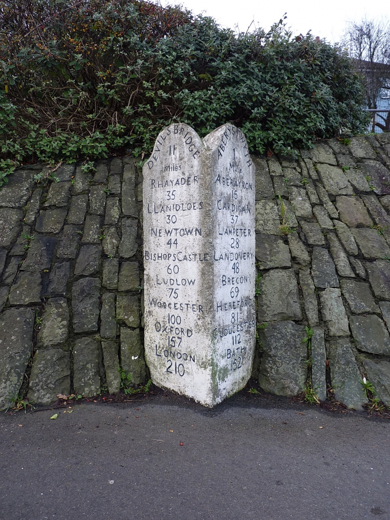
C19.
Freestanding triangular shaped whitewashed stone milestone set into a modern rubble embankment. Distances shown in inscribed black lettering to 2 sides both with rounded heads; top reads "Devils Bridge 8 miles" and "Aberystwyth 1 mile".
One of a group in this area.
External links are from the relevant listing authority and, where applicable, Wikidata. Wikidata IDs may be related buildings as well as this specific building. If you want to add or update a link, you will need to do so by editing the Wikidata entry.


Other nearby listed buildings
