Approximate Location Map
Large Map »
Latitude: 52.0181 / 52°1'5"N
Longitude: -4.8373 / 4°50'14"W
OS Eastings: 205409
OS Northings: 239316
OS Grid: SN054393
Mapcode National: GBR CR.H2S8
Mapcode Global: VH2MZ.3JLT
Plus Code: 9C4Q2597+63
Entry Name: Spring Hill
Listing Date: 14 April 1992
Last Amended: 14 April 1992
Grade: II
Source: Cadw
Source ID: 12502
Building Class: Domestic
ID on this website: 300012502
Location: Semi-detached pair situated some 300m N of junction with West Street.
County: Pembrokeshire
Community: Newport (Trefdraeth)
Community: Newport
Built-Up Area: Newport
Traditional County: Pembrokeshire
Tagged with: Building
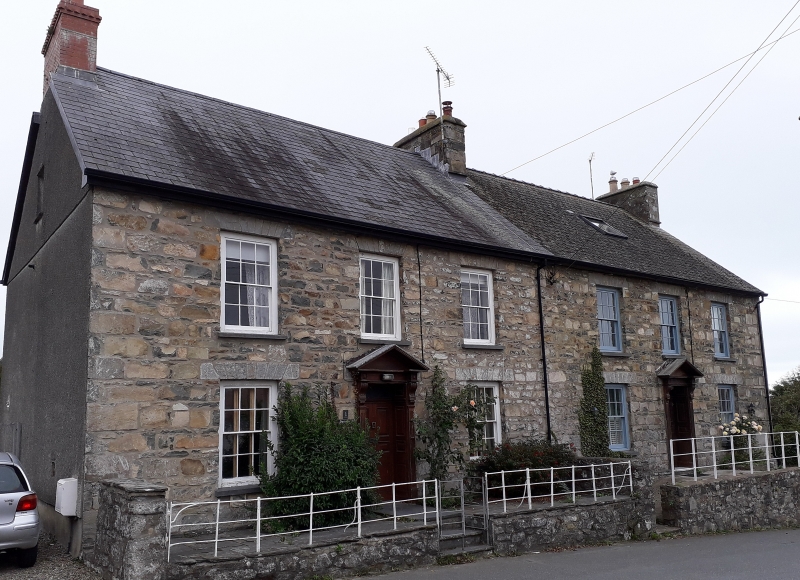
Mid to later C19 pair of substantial houses with coursed rubble stone fronts, slate roofs and stone ridge and end-wall stacks. Two-storeys and loft, each with 3-window range of hornless 12-pane sashes and centre doors. Cut stone voussoirs and slate sills to windows, 6-panel doors with four fielded panels, panelled reveals and timber pedimented doorcases. Open pediments on carved brackets. Plain overlights over doors. Both houses are raised on rubble stone terrace, higher at N end, with plain iron railings.
N end wall is roughcast with 2 ground floor sashes and one to first floor, all 12-pane with horns. Small loft light.
A good and little altered pair of houses with doorcases of quality.
External links are from the relevant listing authority and, where applicable, Wikidata. Wikidata IDs may be related buildings as well as this specific building. If you want to add or update a link, you will need to do so by editing the Wikidata entry.


Other nearby listed buildings
