Approximate Location Map
Large Map »
Latitude: 51.4557 / 51°27'20"N
Longitude: -3.4613 / 3°27'40"W
OS Eastings: 298564
OS Northings: 173978
OS Grid: SS985739
Mapcode National: GBR HK.MG2Z
Mapcode Global: VH5HS.YNHY
Plus Code: 9C3RFG4Q+7F
Entry Name: Roadside Cross
Listing Date: 22 February 1963
Last Amended: 16 September 1999
Grade: II
Source: Cadw
Source ID: 13145
Building Class: Religious, Ritual and Funerary
ID on this website: 300013145
Location: About 100m SE of Llanblethian Church.
County: Vale of Glamorgan
Community: Cowbridge with Llanblethian (Y Bont-faen a Llanfleiddan)
Community: Cowbridge with Llanblethian
Locality: Llanblethian
Built-Up Area: Cowbridge
Traditional County: Glamorgan
Tagged with: Wayside cross Stone cross
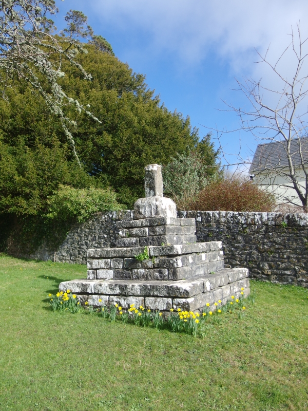
Medieval origins.
Remains of roadside cross. Stump of square shaft in square socket on base of three restored square steps. Sides of socket retain traces of arcading.
Listed for remaining medieval structure.
External links are from the relevant listing authority and, where applicable, Wikidata. Wikidata IDs may be related buildings as well as this specific building. If you want to add or update a link, you will need to do so by editing the Wikidata entry.


Other nearby listed buildings
