Approximate Location Map
Large Map »
Latitude: 51.5142 / 51°30'51"N
Longitude: -3.2215 / 3°13'17"W
OS Eastings: 315331
OS Northings: 180183
OS Grid: ST153801
Mapcode National: GBR K67.M5
Mapcode Global: VH6F6.36RK
Plus Code: 9C3RGQ7H+M9
Entry Name: The Laurels
Listing Date: 19 May 1975
Last Amended: 31 May 2002
Grade: II
Source: Cadw
Source ID: 13776
Building Class: Domestic
ID on this website: 300013776
Location: On the main road about 100m north of the Church of St. Mary.
County: Cardiff
Town: Cardiff
Community: Whitchurch (Yr Eglwys Newydd)
Community: Whitchurch
Built-Up Area: Cardiff
Traditional County: Glamorgan
Tagged with: Architectural structure
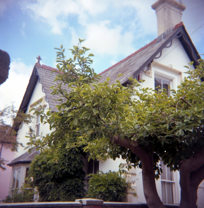
A small mid C19 villa in Tudor style having group value with the adjoining No 27A.
Stuccoed two storey two-bay front with gable with curvilinear bargeboards and cross finial over the left hand bay, Welsh slate roof with ridge tiles. L-shaped plan with rusticated quoins. The northern bay has a sash window with 2 over 2 panes and a square dripmould on first floor; bay window on ground floor. Southern bay with sash window with dripmould on ground floor, gable stack. In south return a further gable over first floor window. Side elevations plain, left return with door, window and two truncated stacks, rear elevation not seen.
Interior not seen at resurvey (November 2001).
Included as a mid C19 villa of character having group value with No 27A next door.
External links are from the relevant listing authority and, where applicable, Wikidata. Wikidata IDs may be related buildings as well as this specific building. If you want to add or update a link, you will need to do so by editing the Wikidata entry.


Other nearby listed buildings
