Approximate Location Map
Large Map »
Latitude: 51.5004 / 51°30'1"N
Longitude: -3.5842 / 3°35'3"W
OS Eastings: 290133
OS Northings: 179129
OS Grid: SS901791
Mapcode National: GBR HD.JM52
Mapcode Global: VH5HJ.TKJ5
Plus Code: 9C3RGC28+58
Entry Name: Coach House at Glanogwr
Listing Date: 29 September 1986
Last Amended: 29 September 1986
Grade: II
Source: Cadw
Source ID: 15680
Building Class: Domestic
ID on this website: 300015680
Location: Situated to N of Glanogwr House at the end of the road.
County: Bridgend
Community: Bridgend (Pen-y-bont ar Ogwr)
Community: Bridgend
Built-Up Area: Bridgend
Traditional County: Glamorgan
Tagged with: Carriage house
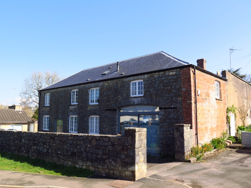
Late C18/early C19, contemporary with the house.
2-storey rubble former coach house, brick English garden wall bond SE wall with stretchers laid on their sides; hipped slate roof and brick chimney stacks. Cambered voussior heads to various metal frame windows on S side; boarded loft opening to far end and plain rubble rear.
Included for group value.
External links are from the relevant listing authority and, where applicable, Wikidata. Wikidata IDs may be related buildings as well as this specific building. If you want to add or update a link, you will need to do so by editing the Wikidata entry.


Other nearby listed buildings
