Approximate Location Map
Large Map »
Latitude: 52.1348 / 52°8'5"N
Longitude: -4.6399 / 4°38'23"W
OS Eastings: 219418
OS Northings: 251791
OS Grid: SN194517
Mapcode National: GBR D0.7PRF
Mapcode Global: VH2MH.JLDS
Plus Code: 9C4Q49M6+W2
Entry Name: Lime Kiln at Mwnt
Listing Date: 6 March 1995
Last Amended: 6 March 1995
Grade: II
Source: Cadw
Source ID: 15866
Building Class: Industrial
ID on this website: 300015866
Location: Situated above and to the S of Mwnt beach.
County: Ceredigion
Community: Y Ferwig
Community: Y Ferwig
Locality: Mwnt
Traditional County: Cardiganshire
Tagged with: Lime kiln
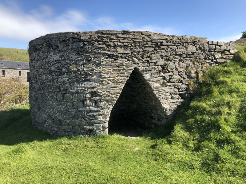
Early C19 lime kiln, the surviving one of three at Mwnt marked on 1839/40 Tithe Map.
Early C19 circular rubblestone lime kiln built into bank. One tall kiln eye on N side, triangular and tapering within. Partly infilled crucible.
Listed as a good example of a lime kiln of this area.
External links are from the relevant listing authority and, where applicable, Wikidata. Wikidata IDs may be related buildings as well as this specific building. If you want to add or update a link, you will need to do so by editing the Wikidata entry.


Other nearby listed buildings
