Approximate Location Map
Large Map »
Latitude: 52.0309 / 52°1'51"N
Longitude: -3.2622 / 3°15'43"W
OS Eastings: 313503
OS Northings: 237697
OS Grid: SO135376
Mapcode National: GBR YV.G9F8
Mapcode Global: VH6BN.D6RY
Plus Code: 9C4R2PJQ+94
Entry Name: Llyswen Presbyterian Church
Listing Date: 15 December 1995
Last Amended: 15 December 1995
Grade: II
Source: Cadw
Source ID: 16695
Building Class: Religious, Ritual and Funerary
Also known as: Llyswen Presbyterian Church
ID on this website: 300016695
Location: Located within its own linear churchyard, alongside the main Builth to Crickhowell Road, just beyond the S end of Llyswen village. The churchyard has a stone wall with a gate opening along the road f
County: Powys
Community: Bronllys
Community: Bronllys
Locality: Llyswen
Traditional County: Brecknockshire
Tagged with: Church building Chapel
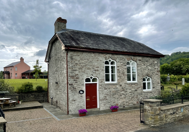
History: Calvinistic Methodist Chapel, built c.1836 and renovated 1879. Transferred to the Presbyterian Church in 1904 and since served by Coleg Trefeca.
Exterior: Rendered stone with slate roof, quarter hipped at both ends. Single cell. Eastern side, facing road retains the traditional long-wall front formerly with doorways at either end. Now only the one entrance at the S end has double panelled doors with depressed ogee overlight. Two 4-paned windows, one quadrant pivot hung, and both with similar ogee shaped heads, the glazing bars forming a lozenge-shaped light. At N end, a low set window with similar head, the original door opening. Boxed eaves and moulded frieze. Shaped bargeboards. The N and W sides both have round-headed windows.
Interior: The internal plan was altered in the 1879 remodelling. Timber lobby around entrance doors. Walls plastered with a matchboarded dado. Moulded ribs form a panelled flat ceiling, having a central snowflake design. Raised pulpit under the N end window with a portable harmonium in front. Blocked fireplace on S wall. Three blocks of pews and some cross pews facing the pulpit.
Included as a conspicuous example of a small rural chapel, retaining the character of the pre-1840 building.
External links are from the relevant listing authority and, where applicable, Wikidata. Wikidata IDs may be related buildings as well as this specific building. If you want to add or update a link, you will need to do so by editing the Wikidata entry.


Other nearby listed buildings
