Approximate Location Map
Large Map »
Latitude: 51.6845 / 51°41'4"N
Longitude: -5.0879 / 5°5'16"W
OS Eastings: 186639
OS Northings: 202926
OS Grid: SM866029
Mapcode National: GBR G4.ZXJC
Mapcode Global: VH1RX.RXLK
Plus Code: 9C3PMWM6+QR
Entry Name: Sailors' Chapel
Listing Date: 14 May 1970
Last Amended: 26 January 1996
Grade: I
Source: Cadw
Source ID: 17147
Building Class: Religious, Ritual and Funerary
Also known as: Seamen's Chapel
Fishermen's Chapel
ID on this website: 300017147
Location: At N side of St Mary's Church, within the Churchyard.
County: Pembrokeshire
Community: Angle
Community: Angle
Traditional County: Pembrokeshire
Tagged with: Chapel
Single-cell vaulted chapel standing above a raised and vaulted crypt. Probably C15 or C16. Restored in 1853, restored again by Elizabeth Mirehouse in 1862, rededicated in 1929. Now used as a Chapel of Rest, formerly used for receiving the corpses of drowned sailors. Also known as the Seamen's or Fishermen's Chapel.
Good quality coursed masonry. Modern red tiled roof with C19 verge parapets and one finial cross of Celtic form. Small unglazed cinquefoil apertures to crypt at N and S. Crypt entrance at E. The chapel entrance is by a flight of steps at W. Single trefoil-headed window at S and a pair of similar lights at E.
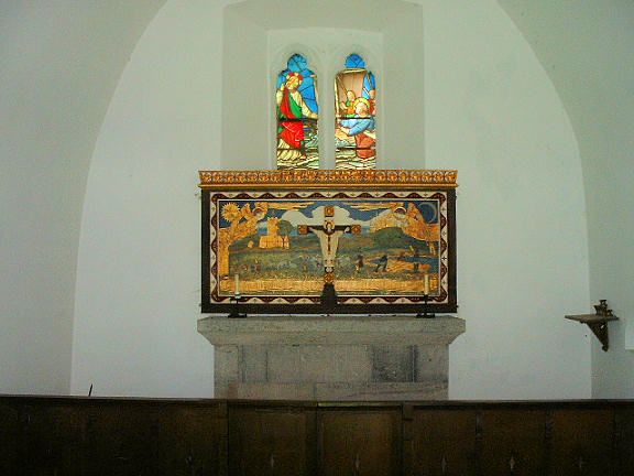
Plain stone altar said to have come from St Twinnel's; surface tooling entirely modern. Simple small piscina. Some mediaeval encaustic tiles relaid in modern pattern within altar rail. Altar rail supported on pierced oak panels. Effigy of an unidentified ecclesiastic lies close to the S wall. Victorian stained glass; E window depicts the miracle of Christ walking upon the Sea.
Listed as a well-preserved mediaeval charnel chapel
External links are from the relevant listing authority and, where applicable, Wikidata. Wikidata IDs may be related buildings as well as this specific building. If you want to add or update a link, you will need to do so by editing the Wikidata entry.


Other nearby listed buildings
