Approximate Location Map
Large Map »
Latitude: 51.5615 / 51°33'41"N
Longitude: -2.9458 / 2°56'44"W
OS Eastings: 334534
OS Northings: 185164
OS Grid: ST345851
Mapcode National: GBR J7.DZP1
Mapcode Global: VH7BL.W0KR
Plus Code: 9C3VH363+JM
Entry Name: Pye Corner Farm
Listing Date: 31 October 1996
Last Amended: 31 October 1996
Grade: II
Source: Cadw
Source ID: 17542
Building Class: Domestic
ID on this website: 300017542
Location: At junction of Nash Road and Broad Street.
County: Newport
Town: Newport
Community: Nash (Yr As Fach)
Community: Nash
Traditional County: Monmouthshire
Tagged with: Farmhouse
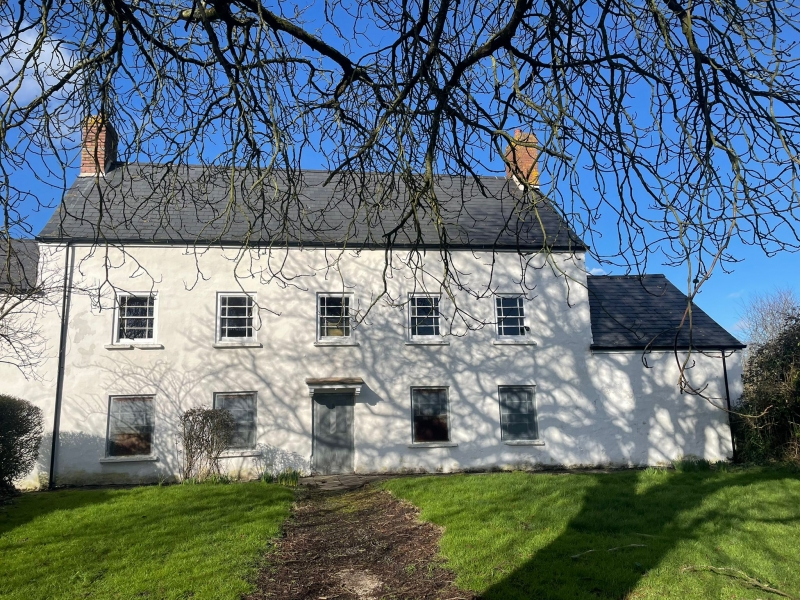
Probable origins as C17 house, rebuilt late C18/early C19, and modernised later C19.
Rendered, over grey stone, slate roof, brick end chimneys. Two storeys, 5 window front, hornless sash windows with marginal glazing bars. Central doorway with flat hood on brackets. Attic window to each gable end. Outshut rear, and lower agricultural block to each end.
Listed as well-preserved farmhouse typical of Gwent levels.
External links are from the relevant listing authority and, where applicable, Wikidata. Wikidata IDs may be related buildings as well as this specific building. If you want to add or update a link, you will need to do so by editing the Wikidata entry.


Other nearby listed buildings
