Approximate Location Map
Large Map »
Latitude: 52.8646 / 52°51'52"N
Longitude: -3.6823 / 3°40'56"W
OS Eastings: 286842
OS Northings: 331007
OS Grid: SH868310
Mapcode National: GBR 69.RD12
Mapcode Global: WH67B.D8R8
Plus Code: 9C4RV879+R3
Entry Name: Ty'r Hen Gapel
Listing Date: 12 April 1996
Last Amended: 31 January 2001
Grade: II
Source: Cadw
Source ID: 17920
Building Class: Domestic
Also known as: Tŷ'r Hen Gapel, Llanuwchllyn
ID on this website: 300017920
Location: To N of minor road from A 494 (near Llanuwchllyn) to Dolhendre, about 600m from junction with A 494. Attached to L (W) of chapel and set back behind slab-coped rubble forecourt walls.
County: Gwynedd
Town: Bala
Community: Llanuwchllyn
Community: Llanuwchllyn
Locality: Dolhendre
Traditional County: Merionethshire
Tagged with: Architectural structure
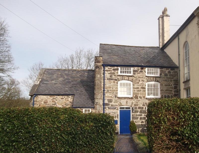
Probably built 1810, contemporary with rebuilding of chapel (which was rebuilt once more 1871). Birthplace of Michael D Jones (2 March1822- 2 Dec 1898), Independent minister, educationalist, and co-founder of Welsh colony in Patagonia. Jones is buried in adjacent graveyard.
Former manse of two storeys plus attic. Of grey stone construction with slate roof. Two window front. Hornless sash windows - 16-pane to ground floor, 12-pane to first floor and 10-pane to second floor; shallow windows to attic level, camber-headed windows to first floor; on ground floor, camber-headed window to R, and cambered doorway with modern boarded door; 2-pane overlight. The rear of the house has tall windows to R and L; single window to each floor.
Adjoining to the L of manse is a former stable and service block, recently restored.
The interior was not inspected at the time of survey.
Listed as an early C19 manse, the birthplace of Michael D Jones, the C19 Independent minister, educationalist and co-founder of Welsh Patagonia.
Group value with the adjoining chapel.
External links are from the relevant listing authority and, where applicable, Wikidata. Wikidata IDs may be related buildings as well as this specific building. If you want to add or update a link, you will need to do so by editing the Wikidata entry.


Other nearby listed buildings
