Approximate Location Map
Large Map »
Latitude: 53.1534 / 53°9'12"N
Longitude: -3.1052 / 3°6'18"W
OS Eastings: 326185
OS Northings: 362376
OS Grid: SJ261623
Mapcode National: GBR 71.586C
Mapcode Global: WH776.8ZKX
Plus Code: 9C5R5V3V+9W
Entry Name: Llong Bridge
Listing Date: 5 August 1997
Last Amended: 5 August 1997
Grade: II
Source: Cadw
Source ID: 18722
Building Class: Transport
ID on this website: 300018722
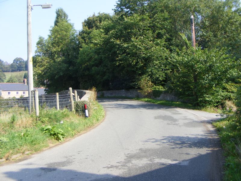
Location: Situated close to the junction of the B5444 and the A5118 at Llong, crossing the River Alyn.
County: Flintshire
Community: Argoed
Community: Argoed
Locality: Llong
Traditional County: Flintshire
Tagged with: Bridge Road bridge
Probably built early C19.
Rubble with ashlar dressings. The bridge has a broad segmented arch over the Alyn and a smaller semi-circular flood arch to the north. The arches are of dressed stone and the main arch is set between piers with a string course running between them. The parapet is of flat coping stones and the bridge is attached to splayed walls on each side.
Listed as a good example of a C19 bridge.
External links are from the relevant listing authority and, where applicable, Wikidata. Wikidata IDs may be related buildings as well as this specific building. If you want to add or update a link, you will need to do so by editing the Wikidata entry.


Other nearby listed buildings
