Approximate Location Map
Large Map »
Latitude: 53.0255 / 53°1'31"N
Longitude: -3.562 / 3°33'43"W
OS Eastings: 295330
OS Northings: 348725
OS Grid: SH953487
Mapcode National: GBR 6F.FK6R
Mapcode Global: WH66M.861W
Plus Code: 9C5R2CGQ+65
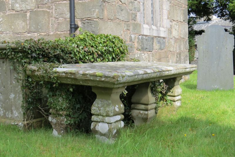
Entry Name: Table Tomb in the churchyard of the Church of St Mary Magdalene
Listing Date: 17 February 1998
Last Amended: 17 February 1998
Grade: II
Source: Cadw
Source ID: 19346
Building Class: Religious, Ritual and Funerary
ID on this website: 300019346
Location: The tomb is located in the churchyard, approximately 2m SW of the Geeler Chapel.
County: Conwy
Community: Cerrigydrudion
Community: Cerrigydrudion
Built-Up Area: Cerrigydrudion
Traditional County: Denbighshire
Tagged with: Tomb
Erected c1845.
Constructed of stone. A moulded ledger slab raised on six square moulded balusters, and inscribed to Edward Pr.....
Included for group value with the Church of St Mary Magdalene.
External links are from the relevant listing authority and, where applicable, Wikidata. Wikidata IDs may be related buildings as well as this specific building. If you want to add or update a link, you will need to do so by editing the Wikidata entry.


Other nearby listed buildings
