Approximate Location Map
Large Map »
Latitude: 51.4899 / 51°29'23"N
Longitude: -3.7019 / 3°42'6"W
OS Eastings: 281934
OS Northings: 178145
OS Grid: SS819781
Mapcode National: GBR H7.K7KF
Mapcode Global: VH5HG.ST96
Plus Code: 9C3RF7QX+X6
Entry Name: The Farmers' Arms
Listing Date: 17 February 1998
Last Amended: 17 February 1998
Grade: II
Source: Cadw
Source ID: 19372
Building Class: Commercial
Also known as: Farmers Arms, Nottage
Farmers Arms, Nottage, Porthcawl
Farmers Arms
ID on this website: 300019372
Location: Near the centre of the old village and backing onto the Village Green.
County: Bridgend
Town: Porthcawl
Community: Porthcawl
Community: Porthcawl
Locality: Nottage
Built-Up Area: Porthcawl
Traditional County: Glamorgan
Tagged with: Pub
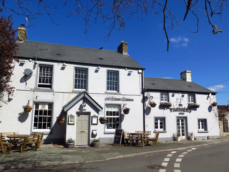
Reputedly the oldest surviving inn in the village, the older unit to right probably C18 though possibly with earlier origins, larger added unit left probably mid to later C19. Photograph c 1900 shows building much as at present.
Of stone, pebbledashed, with painted rendered surrounds and sills to front, rendered to side and rear; Welsh slate roof, stone end stack to early unit right, yellow brick end stacks to later left; stone single storey cross wing at rear at junction of two builds and further parallel wing create a rear courtyard. 2 bay front range right has small 6/6 pane casement windows to first floor and similar larger to ground; former central doorway now has window. Later range left has deep 8/8 pane horned sash windows with painted rendered surrounds and cambered heads; central gabled porch, mostly renewed.
Interior mainly refurbished but batter to rear wall of older unit visible.
Listed as the oldest surviving public house retaining externally much of its character.
External links are from the relevant listing authority and, where applicable, Wikidata. Wikidata IDs may be related buildings as well as this specific building. If you want to add or update a link, you will need to do so by editing the Wikidata entry.


Other nearby listed buildings
