Approximate Location Map
Large Map »
Latitude: 51.6933 / 51°41'35"N
Longitude: -4.2307 / 4°13'50"W
OS Eastings: 245917
OS Northings: 201752
OS Grid: SN459017
Mapcode National: GBR GR.CG39
Mapcode Global: VH3M9.MP8R
Plus Code: 9C3QMQV9+8P
Entry Name: Old house, including attached bakehouse, at Llettyrychen Fawr Farm
Listing Date: 23 July 1998
Last Amended: 25 November 2003
Grade: II
Source: Cadw
Source ID: 20147
Building Class: Domestic
ID on this website: 300020147
Location: About 1.5km NE of Burry Port, on S side of minor road between A484 and B4308.
County: Carmarthenshire
Town: Llanelli
Community: Pembrey and Burry Port Town (Pembre a Phorth Tywyn)
Community: Pembrey and Burry Port Town
Locality: Llettyrychen
Traditional County: Carmarthenshire
Tagged with: Bakehouse
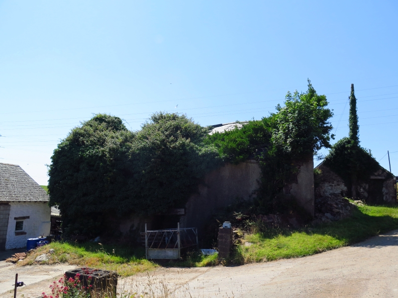
Llettyrychen was the home of the Vaughan family in the C16, passing to the Mansels of Briton Ferry, and by 1690 was leased to John Bonvill, yeoman. The present house is late medieval in origin, incorporating a 1st-floor chamber with arched-brace trusses. In the C17 a central fireplace was inserted, creating the present lobby-entry plan, with contemporary projecting bay to the rear of the hall. A bakehouse was added at the NW angle of the house in the late C17 or C18. In the C19 a stair projection was built at the rear (now collapsed), and a dairy was built against the uphill gable end, which has subsequently been taken down. The house remained inhabited until c1956 when a new farmhouse was built.
A 2-storey house of rubble stone with roughcast front, and slate roof to the R-hand unit, but collapsed to the L-hand, behind coped gables. A central stack has been removed. In the L gable end is a corbelled 1st-floor stack, but taken down to below ridge level. Windows have mostly lost their glazing. The front has a C16 doorway L of centre, in a chamfered dressed-stone surround with 4-centred head. To its R is a window then a former doorway, now partially blocked, to the original hall, and with a single window to the L. The upper storey has 3 windows. In the R gable end is the scar of a former attached dairy. A single 4-pane horned sash window is in the L gable end, where there are dressed stone jambs of an earlier window. In the rear elevation the wall has collapsed on the R-hand side. The L-hand side has a lean-to hall bay, with small single-light window in its side wall, to the R of which are windows in each storey with wooden lintels, and a wide inserted doorway.
Attached to the rear L, or NW angle, is a 2-storey former bakehouse of rubble stone and bigger quoins, behind which is a roughcast lean-to attached to the rear of the main house.
The house has a 2-unit lobby-entry plan. The hall, on the R side, has a timber lintel to its large fireplace. The upper-storey floors have collapsed. The room above the hall has 3 C16 arched-brace trusses. In the bakehouse is a large fireplace.
Listed as a substantial C16 storeyed house, with particularly rare arch-braced roof to the upper chamber.
External links are from the relevant listing authority and, where applicable, Wikidata. Wikidata IDs may be related buildings as well as this specific building. If you want to add or update a link, you will need to do so by editing the Wikidata entry.


Other nearby listed buildings
