Approximate Location Map
Large Map »
Latitude: 52.9285 / 52°55'42"N
Longitude: -4.3844 / 4°23'3"W
OS Eastings: 239819
OS Northings: 339448
OS Grid: SH398394
Mapcode National: GBR 5C.MHDZ
Mapcode Global: WH44B.MNC9
Plus Code: 9C4QWJH8+96
Entry Name: Bwlch y ffordd isaf
Listing Date: 8 February 1999
Last Amended: 8 February 1999
Grade: II
Source: Cadw
Source ID: 21334
Building Class: Domestic
ID on this website: 300021334
Location: The farm is about 400m N of Y Ffor crossroads, at the junction of a minor road to Pencaenewydd.
County: Gwynedd
Town: Pwllheli
Community: Llannor
Community: Llannor
Locality: Y Ffor
Traditional County: Caernarfonshire
Tagged with: Farmhouse
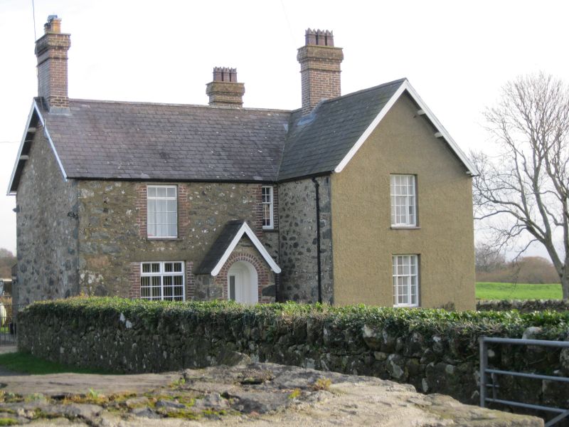
The farm was newly erected by the Glynllifon Estate of Lord Newborough in c1880, and probably replacing an earlier farm.
Built of local stone rubble and pebbledashed in parts, with slated roofs and deep soffits and eaves. Two storeys, the main elevation facing S over the garden. Three bays, the central bay broken forward and steeply gabled, and having an arched entrance porch on the ground floor. Modern door. Two bay rear wing, with an added porch on the W side, and later infill in the NE re-entrant angle. To either side of the porch, original timber windows to both floors, consisting of 2 slender chamfered mullions and transoms, the lower central section consisting of a 6-pane rising sash, designed to be pegged at the chosen height. Two pane by five sash window over the porch. The windows have red brick dressings each side, although covered with pebbledash to the front. Tall gable stacks built of blue brick, each with 3 closely set crenellated pots.
Included as a good example of an estate built farmhouse of the later C19, with plan and detail characteristic of the Glynllifon Estate.
External links are from the relevant listing authority and, where applicable, Wikidata. Wikidata IDs may be related buildings as well as this specific building. If you want to add or update a link, you will need to do so by editing the Wikidata entry.


Other nearby listed buildings
