Approximate Location Map
Large Map »
Latitude: 52.9283 / 52°55'42"N
Longitude: -4.347 / 4°20'49"W
OS Eastings: 242337
OS Northings: 339349
OS Grid: SH423393
Mapcode National: GBR 5F.MDJ9
Mapcode Global: WH44C.6N8F
Plus Code: 9C4QWMH3+86
Entry Name: Former School in the churchyard of the Church of St Garmon
Listing Date: 31 March 1999
Last Amended: 31 March 1999
Grade: II
Source: Cadw
Source ID: 21583
Building Class: Education
ID on this website: 300021583
Location: The schoolroom is in the E side of the churchyard, set back from and accessed from the encircling road.
County: Gwynedd
Town: Pwllheli
Community: Llanystumdwy
Community: Llanystumdwy
Locality: Llanarmon
Traditional County: Caernarfonshire
Tagged with: School building
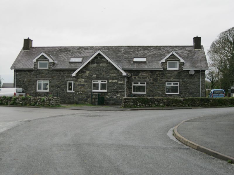
The school room for the village was probably built in the late C18 or early C19. The front was altered in the early C20 by the lord of the manor to garage his new motor car when he attended church.
Coursed large stone rubble, with a grouted slate roof and superimposed slate copings at the W end. A single cell building with a boarded door and two timber cross windows on the S side with diamond lattice glazing. Two paned windows on the N side. Three steps against the W gable end give access to the door opening to the roof space. At the front, facing the road, the churchyard walls incurve to off-centre boarded doors for the present garage.
The roof structure has two tiers of purlins.
Included as a building retaining the character of the C18 or early C19, particularly as seen from the churchyard, and of group value with other listed buildings at the centre of the village.
External links are from the relevant listing authority and, where applicable, Wikidata. Wikidata IDs may be related buildings as well as this specific building. If you want to add or update a link, you will need to do so by editing the Wikidata entry.


Other nearby listed buildings
