Approximate Location Map
Large Map »
Latitude: 51.6161 / 51°36'58"N
Longitude: -3.018 / 3°1'4"W
OS Eastings: 329615
OS Northings: 191301
OS Grid: ST296913
Mapcode National: GBR J4.9KKM
Mapcode Global: VH7B5.MMWY
Plus Code: 9C3RJX8J+CR
Entry Name: Bridge over the Monmouthshire and Brecon Canal SE of Pentwyn (partly in Bettws community)
Listing Date: 24 June 1999
Last Amended: 24 June 1999
Grade: II
Source: Cadw
Source ID: 21947
Building Class: Transport
Also known as: Bridge over the Monmouthshire and Brecon Canal SE of Pentwyn (partly in Malpas community)
ID on this website: 300021947
Location: Located some 20 metres SE of Pentwyn.
County: Newport
Community: Malpas
Community: Malpas
Locality: Pentwyn
Traditional County: Monmouthshire
Tagged with: Bridge Road bridge
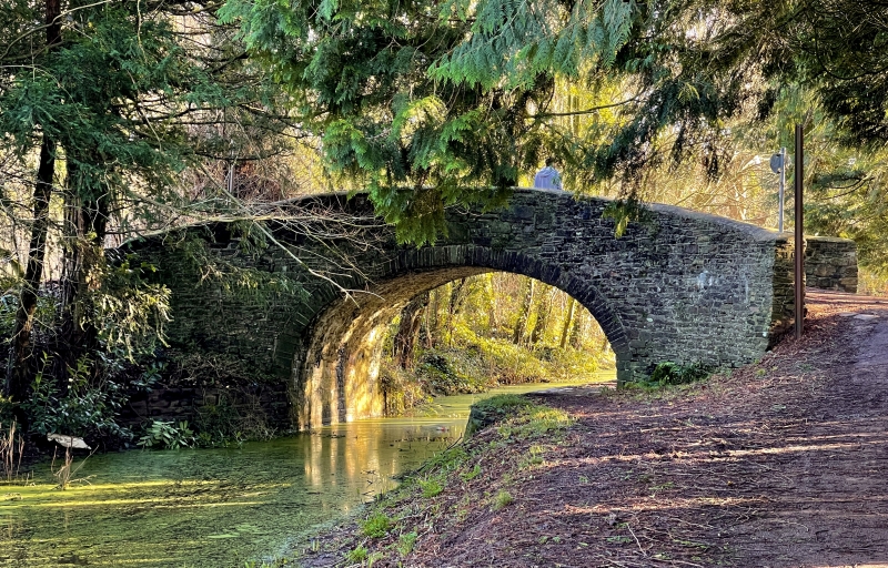
Built c. 1795. The eastern branch of the Monmouthshire and Brecon Canal was authorised by Act of Parliament in 1792, and officially opened in 1799. It ran from Newport to Pontnewynydd, and was engineered by Thomas Dadford Jnr. The canal connected with several tramroads belonging to the same company (Monmouthshire Canal Navigation Company), carrying coal down to the wharves. The branch was 11 miles (18.6 kilometres) long and rose 447 feet (136 metres) through 42 locks. The contemporary western branch, 12 miles (20.3 kilometres) long, ran to Crumlin. In 1812, the eastern branch was connected to the Brecon and Abergavenny Canal at Pontymoile Basin, and this became the main line. In 1853-55, the Monmouthshire Railway and Canal Company built a railway down to Newport, the company amalgamating with the Great Western Railway in 1880. The canal then became increasingly disused. The Crumlin branch closed in 1949, the main line in 1962.
Rubble-built hump-backed bridge. Semi-elliptical arch with stone voussoirs. Parapets with cement copings, splayed to square piers on W side. Towing path runs under bridge, along W side.
Listed as a significant element of the engineering works associated with the Monmouthshire and Brecon Canal.
External links are from the relevant listing authority and, where applicable, Wikidata. Wikidata IDs may be related buildings as well as this specific building. If you want to add or update a link, you will need to do so by editing the Wikidata entry.


Other nearby listed buildings
