Approximate Location Map
Large Map »
Latitude: 51.463 / 51°27'46"N
Longitude: -3.4534 / 3°27'12"W
OS Eastings: 299128
OS Northings: 174779
OS Grid: SS991747
Mapcode National: GBR HK.M41G
Mapcode Global: VH6F8.3H5B
Plus Code: 9C3RFG7W+5J
Entry Name: 34, Westgate, Cowbridge
Listing Date: 16 September 1999
Last Amended: 16 September 1999
Grade: II
Source: Cadw
Source ID: 22292
Building Class: Domestic
ID on this website: 300022292
Location: About 40m E of Police Station.
County: Vale of Glamorgan
Community: Cowbridge with Llanblethian (Y Bont-faen a Llanfleiddan)
Community: Cowbridge with Llanblethian
Locality: Cowbridge
Built-Up Area: Cowbridge
Traditional County: Glamorgan
Tagged with: Building
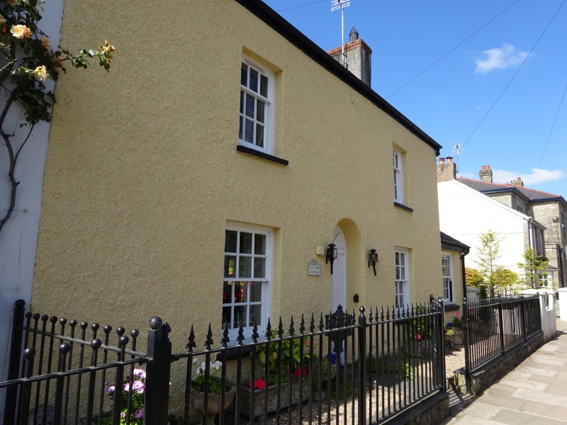
Early C19 house; on Tithe Map of 1841.
Two storey, 2 window house with centre doorway. Pebbledash; slate roof with end chimneys. First floor windows are small-pane top-hung sashes. On ground floor, fixed windows of 12 panes. Round-arched doorway with blocked fanlight and modern door.
Early C19 house retaining much of its historic character.
External links are from the relevant listing authority and, where applicable, Wikidata. Wikidata IDs may be related buildings as well as this specific building. If you want to add or update a link, you will need to do so by editing the Wikidata entry.


Other nearby listed buildings
