Approximate Location Map
Large Map »
Latitude: 51.5766 / 51°34'35"N
Longitude: -4.0047 / 4°0'17"W
OS Eastings: 261178
OS Northings: 188324
OS Grid: SS611883
Mapcode National: GBR GX.FFRV
Mapcode Global: VH4KG.JMQQ
Plus Code: 9C3QHXGW+M4
Entry Name: Lime Kiln adjacent to Castle Road
Listing Date: 29 October 1999
Last Amended: 29 October 1999
Grade: II
Source: Cadw
Source ID: 22558
Building Class: Industrial
ID on this website: 300022558
Location: Approximately 0.6km NW of Oystermouth church.
County: Swansea
Town: Swansea
Community: Mumbles (Y Mwmbwls)
Community: Mumbles
Locality: Oystermouth
Built-Up Area: Swansea
Traditional County: Glamorgan
Tagged with: Lime kiln
The limestone industry of the Gower reached its peak in the late C19 when burnt lime was supplied to local industries and was exported across the Bristol Channel. The 2 large kilns at Coltshill Quarry demonstrate the increased scale of industrial limeworking in the C19. Exploitation of limestone on land at Coltshill Farm was established by the mid C19. The Oystermouth Tithe Map of 1844 shows the 2 large kilns (although they are not referred to in the apportionment) as well as 'Quarry Fields' and 'Kiln Fields' nearby. The kilns later became part of a larger concern at Coltshill known as Norton Lime Works. The capacity of the kilns was probably 30 waggon loads per charge, and the combined output of the 2 kilns was said to be 6600 tons per year. They were probably operated continuously and supplied the Cwmfelin Steel and Tinplate Works until its closure in 1957-8. Production continued until the early 1960s, supplying other steelworks. The kilns were subsequently infilled. (The quarry was subsequently the site of an Asphalt Coating Works and is now redeveloped as a housing estate.)
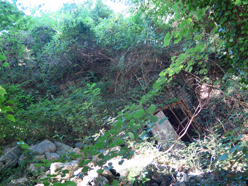
A lime kiln of coursed rubble stone with a tall tapering stack, now covered in dense vegetation, built against a steep bank to facilitate charging from the top and drawing from the bottom. The original draw arch is segmental and of brick, at the back of which the draw hole has a brick surround. A later, higher draw arch is added in front of it which is integral with a rubble stone retaining wall built across the full width of the kiln. The later draw arch has dressed stone voussoirs. In front of the draw arch is a C20 concrete platform with blockwork flanking walls and a loading bay.
Listed as one of a pair of large kilns representing a once important local industry and its development in the C19.
External links are from the relevant listing authority and, where applicable, Wikidata. Wikidata IDs may be related buildings as well as this specific building. If you want to add or update a link, you will need to do so by editing the Wikidata entry.


Other nearby listed buildings
