History in Structure

Pont Abercorris, also known as Bont Pentre (partly in Glantwymyn Community)

A Grade II Listed Building in Corris, Gwynedd

More Photos »
Approximate Location Map
Large Map »

Coordinates

Latitude: 52.6539 / 52°39'14"N

Longitude: -3.8389 / 3°50'19"W

OS Eastings: 275707

OS Northings: 307830

OS Grid: SH757078

Mapcode National: GBR 92.5ZD7

Mapcode Global: WH687.0K79

Plus Code: 9C4RM536+HF

Entry Name: Pont Abercorris, also known as Bont Pentre (partly in Glantwymyn Community)

Listing Date: 6 December 1999

Last Amended: 6 December 1999

Grade: II

Source: Cadw

Source ID: 22729

Building Class: Transport

Also known as: Pont Abercorris also known as Bont Pentre (partly in Corris Community)
Bont Pentre

ID on this website: 300022729

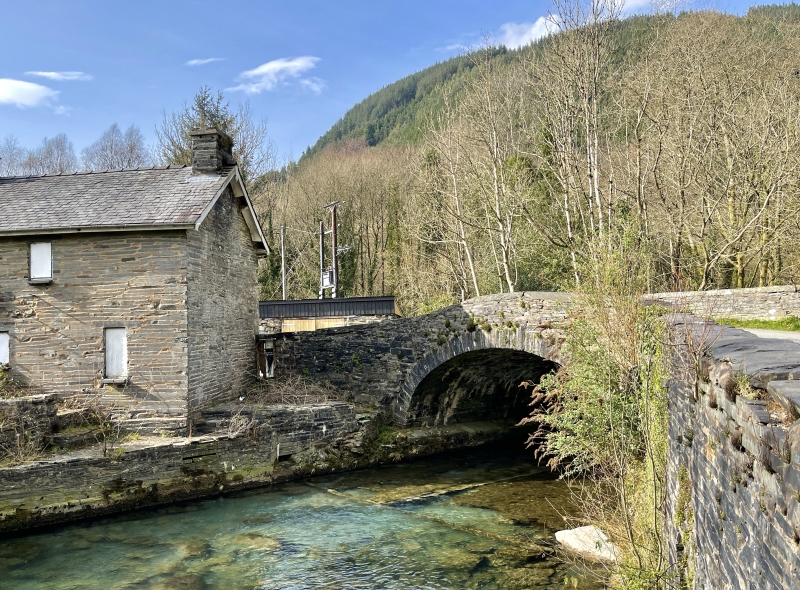
Location: The bridge carries the road E from the centre of Corris, over the Afon Dulas into Powys.

County: Gwynedd

Town: Machynlleth

Community: Corris

Community: Corris

Traditional County: Merionethshire

Tagged with: Bridge Road bridge

Find accommodation in
Aberllefenni

History

The bridge was probably built in the C18 to carry the road over the Afon Dulas into Powys.

Exterior

Built of coursed slate stone. An elliptical arch of squared voussoirs, with flush spandrels and a low parapet, coped with flush cramped shale stone copings. A small square relief culvert passes through the E abutment. The carriageway is slightly humped and the parapet is correspondingly peaked.

Reasons for Listing

Included as a good C18 bridge, unusual for the period in that the arch takes an elliptical form.

External Links

External links are from the relevant listing authority and, where applicable, Wikidata. Wikidata IDs may be related buildings as well as this specific building. If you want to add or update a link, you will need to do so by editing the Wikidata entry.

Recommended Books

Other nearby listed buildings

  • II Pont Abercorris also known as Bont Pentre (partly in Corris Community)
    The bridge carries the road E from the centre of Corris, over the Afon Dulas into Powys.
  • II Yr Efail
    The house is built gable on to the road rising up from the crossing of the Afon Dulas to the centre of Corris.
  • II Tan-y-bryn
    The house is built across the slope, end on to the street, facing NW towards Nos 1 and 2 Pant-y-celyn.
  • II Pant-y-celyn
    Nos 1 and 2 Pant-y-celyn are two cottages in a row off Minffordd Street, behind the properties fronting Bridge Street in the centre of the village.
  • II Pant-y-celyn
    The building forms a short row with No 1, at right angles to Minffordd Street, at the centre of Corris, and facing E across a small garden to a roadway running down to the river.
  • II Railway Overbridge
    The overbridge carried the former Corris Railway over the Nant Deri, in the centre of Corris village.
  • II The Slater's Arms
    The inn is on the corner of Bridge Street and the road running up from the bridge over the Afon Dulas crossing Bridge Street and continuing to the NW.
  • II Idris House
    The building stands in a conspicuous position in the main street of the village, adjoining Capel Salem on the right.

BritishListedBuildings.co.uk is an independent online resource and is not associated with any government department. All government data published here is used under licence. Please do not contact BritishListedBuildings.co.uk for any queries related to any individual listed building, planning permission related to listed buildings or the listing process itself.

British Listed Buildings is a Good Stuff website.