Approximate Location Map
Large Map »
Latitude: 51.6274 / 51°37'38"N
Longitude: -3.8257 / 3°49'32"W
OS Eastings: 273721
OS Northings: 193641
OS Grid: SS737936
Mapcode National: GBR H2.8LDN
Mapcode Global: VH4KC.MCV9
Plus Code: 9C3RJ5GF+XP
Entry Name: Dock walls and gate between inner dock and outer basin at Briton Ferry Docks
Listing Date: 19 May 2000
Last Amended: 19 May 2000
Grade: II*
Source: Cadw
Source ID: 23299
Building Class: Maritime
ID on this website: 300023299
Location: On the S side of the elevated M4 400m E of the River Neath.
County: Neath Port Talbot
Community: Briton Ferry (Llansawel)
Community: Briton Ferry
Locality: Briton Ferry Docks
Traditional County: Glamorgan
Tagged with: Dock
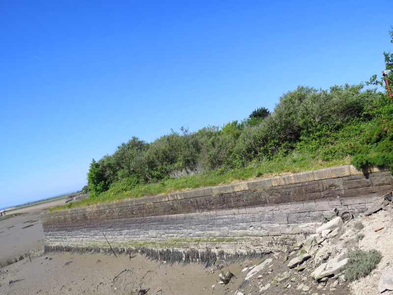
The Briton Ferry Dock Act was passed in 1851 and the dock was opened in 1861. Its engineer was Isambard Kingdom Brunel who died in 1859 before the project was completed. It comprised an inner floating dock and an outer tidal basin, between which was a hydraulically powered lock gate. This was a single buoyant wrought iron gate 56 feet (17.1m) long and 31 feet 6 inches (9.6m) deep at the centre. Only the lower portion of the gate survives, the upper portion having been cut away for scrap. The hydraulic power was generated from the adjacent engine house, of which the tower survives. The dock closed in 1959, subsequent to which the inner floating dock has silted up, with the high-level A48 and M4 built partly over it, and its entrance infilled.
The walls and gate stand at the junction between the inner dock and outer basin. They are of snecked rock-faced sandstone with large dressed coping stones. On the W side of the basin the walls form a large square quay, approximately 70m x 80m, walled on 3 sides with rounded SE corner and a rounded bastion to the NE corner. The opposite quay is narrower, approximately 50m x 15m. The dock walls are strengthened with additional concrete through the channel between the basins. The lock gate is said to survive partially but was not visible at the time of inspection.
Listed grade II* for industrial archaeological interest as the major surviving built component of Brunel's docks, notable for the innovative use of hydraulically powered bouyancy chambers in its lock gate, and for group value with the adjacent engine house.
Scheduled Ancient Monument Gm445 (NEP).
External links are from the relevant listing authority and, where applicable, Wikidata. Wikidata IDs may be related buildings as well as this specific building. If you want to add or update a link, you will need to do so by editing the Wikidata entry.


Other nearby listed buildings
