Approximate Location Map
Large Map »
Latitude: 51.8065 / 51°48'23"N
Longitude: -3.1477 / 3°8'51"W
OS Eastings: 320963
OS Northings: 212602
OS Grid: SO209126
Mapcode National: GBR F0.X7V9
Mapcode Global: VH6CP.DV8K
Plus Code: 9C3RRV42+HW
Entry Name: Milestone at Pont-gam
Listing Date: 27 July 2000
Last Amended: 27 July 2000
Grade: II
Source: Cadw
Source ID: 23841
Building Class: Transport
ID on this website: 300023841
Location: Situated on S side of by-road between Brynmawr and Blackrock. Approximately 2 km W of Blackrock.
County: Monmouthshire
Community: Llanelly (Llanelli)
Community: Llanelly
Locality: Pont-gam
Traditional County: Brecknockshire
Tagged with: Milestone
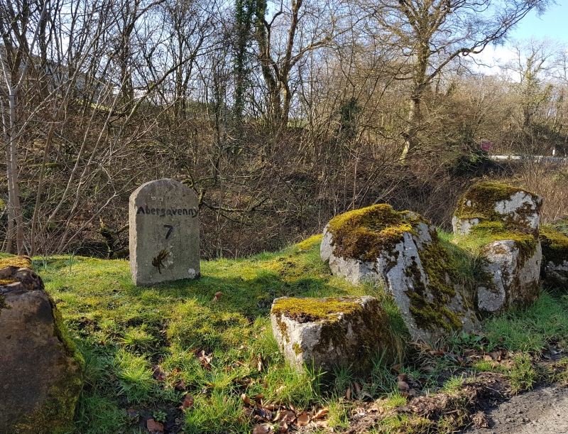
Contemporary with the construction of the road, built 1812-13 by the Merthyr and Govilon Turnpike Trust.
Low milstone with rounded top set in low earth/stone bank. Inscription reads ‘Abergavenny 7’.
Listed as an important survival of early road transport history.
External links are from the relevant listing authority and, where applicable, Wikidata. Wikidata IDs may be related buildings as well as this specific building. If you want to add or update a link, you will need to do so by editing the Wikidata entry.


Other nearby listed buildings
