Approximate Location Map
Large Map »
Latitude: 52.9209 / 52°55'15"N
Longitude: -3.5153 / 3°30'55"W
OS Eastings: 298218
OS Northings: 337017
OS Grid: SH982370
Mapcode National: GBR 6H.N4KP
Mapcode Global: WH670.ZV64
Plus Code: 9C4RWFCM+9V
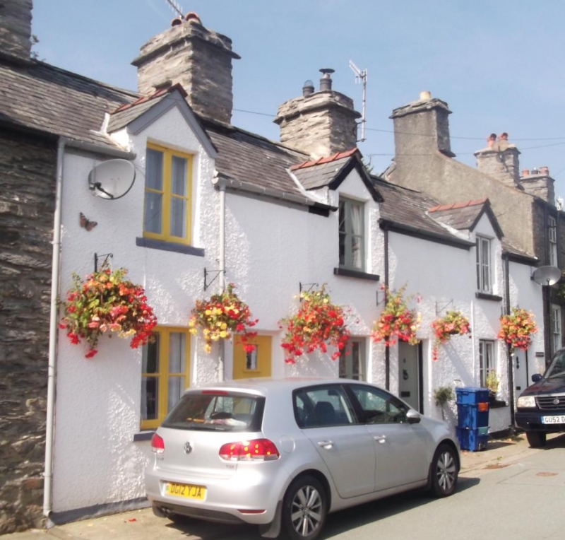
Entry Name: 5, Church Street, Llandderfel, Bala, LL23 7HL
Listing Date: 31 January 2001
Last Amended: 31 January 2001
Grade: II
Source: Cadw
Source ID: 24604
Building Class: Domestic
ID on this website: 300024604
Location: On the street-line.
County: Gwynedd
Town: Bala
Community: Llandderfel
Community: Llandderfel
Traditional County: Merionethshire
Tagged with: Building
Second-quarter C19 terrace with possibly earlier origins; a row of 3 workers' cottages, originally part of a terrace of 4 (the former no.4 substantially altered when incorporated into no.3). The windows were altered in the late C19.
The interior was not inspected at the time of survey.
Listed as a good village row retaining vernacular character as part of a group at the centre of the village.
External links are from the relevant listing authority and, where applicable, Wikidata. Wikidata IDs may be related buildings as well as this specific building. If you want to add or update a link, you will need to do so by editing the Wikidata entry.


Other nearby listed buildings
